Week in Review:
September 9-15
Monday, September 9th
OFF—R&R
Tuesday, September 10th
OFF—R&R
Wednesday, September 11th
OFF—R&R
Thursday, September 12th
PM—10 Miles—2:07—3,600’—Mt.
Werner (First 5 Miles of RRR100 Course)
After a few days of being lazy and driving way too much I
finally put the running shoes back on for an easy day on the first climb of the
Run Rabbit Run 100.
Friday, September 13th
AM—4 Miles—1:15—1,450’—Partial
climb of Mt. Werner
Did part of the first climb of RRR to meet Jason up high and
hand him water and some gels. Mainly hiking since I had my sandals on.
PM—8
Miles—1:09—900’—Two road runs with Jason during RRR
The RRR100 course has two 4-mile stretches of pavement
through Steamboat where pacers are allowed for the hares. So, I joined Jason
for these two stretches.
Saturday, September 14th
OFF—Exhausted from
crewing Jason and watching him run out of Steamboat $10k richer
Sunday, September 15th
OFF—More driving…
Miles— 22
Time—4 hours 32 minutes
Elevation Gain—5,950
feet
For some reason the Elks range just left me feeling mentally
and physically drained. Perhaps I can’t just credit the Elks for this? Maybe
it’s just the cumulative result of an entire summer practically being spent
above treeline with countless miles of driving in between? Regardless, I felt I
needed a little rest. The week I completed the Elks coincided with the week of
crewing Jason Schlarb for Run Rabbit Run and a visit from some Patagonia
friends. Perfect for a recovery week! So, I just ran a couple of times during
the week of September 9-15 and focused more on eating a lot of food and
drinking a lot of beer.
Week in Review:
September 16-22
Monday, September 16th
OFF—Not really sure
why I took this day off?
Tuesday, September 17th
PM—6
Miles—4:22—2,000’—Hike into camp at Lower South Colony Lake
This certainly sucked. First time ever hiking in and camping
overnight for a 14er—and that includes the 40+ mile trip in and out of the
Chicago Basin. I forgot how much it sucks to wear a big, heavy pack.
Wednesday, September 18th
AM—4
Miles—2:43—3,200’—Humboldt Peak (14,064’)
I maybe slept all of an hour last night with the
Patagonian-style winds pummeling the hell out of my tent relentlessly. When I
got out of my tent to take a morning leak I noticed zero visibility conditions
on all peaks except Humboldt. That made my decision on which of the seven 14ers
to head up pretty easy. The route up the West Ridge is pretty
unremarkable—easy, straight-forward, walk up mountain. I felt like the little
kid from “A Christmas Story” with all of the layers I was wearing. The winds
were fierce and cold. Never ran a step of the ascent/descent.
Thursday, September 19th
AM—4
Miles—1:13—100’—Run/hike back to the Taco for more food
I woke up to snow-covered peaks all around me. Eventually visibility
diminished and I couldn’t even see the peaks. So, I decided on a rest day,
which meant I would need more food. I ran down to the Taco to gather up some
calories, more treated water, and utilize the one bar of cell service to check
the weather forecast.
PM—4
Miles—1:13—2,000’—Run/hike back to camp with the food
Easy effort back up to my campsite at Lower South Colony
Lake.
Friday, September 20th
AM—8
Miles—7:13—5,400’—Columbia Point (13,980’), Kit Carson Peak (14,165’),
Challenger Point (14,081’), Columbia Point (again), Obstruction Peak (13,799’)
Pretty easy effort all day. Again, no running. When I
started at 7:30am it was COLD and WINDY, which led me to wearing way too many
layers. The ridge traverse to the Bear’s Playground was over before I knew it.
I decided to skirt around Obstruction Peak and hit it on the return trip. The
route was easy up to Columbia Point. From here down to the saddle between
Columbia Point and Kit Carson was by far the crux of the route, but that’s not
to say it was difficult by any means. Easy high 3rd Class
downclimbing, but a fall certainly wouldn’t be good. This short section was
noticeably easier on the up climb (surprise, surprise). The rest of the trip to
the summit went by somewhat quickly. Heading over to Challenger Point from the
summit of Kit Carson proved to be the highlight of the day. It’s just a 2nd
Class walk over, but it starts with the speedy 3rd Class descent off
Kit Carson and ends up on Kit Carson Avenue—a sweet ledge that wraps all the
way around Kit Carson to the Kit Carson-Challenger saddle. I’m always
fascinated by these natural ledges that make summits easily accessible. On the
return I tagged Columbia Point again just for the hell of it and also made my
way up a few extra hundred feet to Obstruction Peak’s summit. When I was
passing by Kit Carson on my return I ran into another climber and chatted for a
while. Turns out he was a friend of the guy who died on Capitol by falling off
the north face about two months ago, was on the summit with the guy when he
died, and this was his first climb since then. I never caught his name during
our chat. He still seemed noticeably shaken when I watched him descending.
Sending good vibes his way for him to regain that much needed confidence on the
rock…
Saturday, September 21st
AM—6
Miles—7:21—6,250’—Crestone Needle (14,197’), Crestone Peak (14,294’), “East
Crestone” (14,260’)
Another cold start to the day. After a breakfast consisting
of two energy gels I headed out with the intent of hitting Crestone Peak first.
However, I missed the drop off from Broken Hand Pass and made my way towards
Crestone Needle instead. Oh, well. I just rolled with it. Near the crossover
point from the east gully to the west gully I noticed a couple of climbers
about 50 feet above the cross over and yelled at them to make sure they really
wanted to proceed up that 4th Class route. They didn’t. I ended up
sticking around with them for the rest of the trip up and down in an effort to
keep my pace as mellow as possible. In my opinion, the crossover point was
definitely the crux of the route—not difficult, but not a place you’d want to
fall. Everything was surprisingly easy and not very steep considering how steep
the mountain looks from below. Near the top of the west gully there’s an exit
to the right that bypasses the narrow, slightly loose upper portion of the
gully and involves 3rd Class scrambling on some broken
cliffs/ledges. We took this route for the ascent and descended through the
narrow gully. I preferred the cliffs/ledges. The views from the summit were
pretty spectacular. After a few minutes of hanging out on top the wind and cold
finally dictated we head down. The descent on the solid conglomerate rock was a
blast. I would run ahead of the other two quite a ways, wait for them to catch
up, then take off again. At the bottom of the east gully they stopped for a
rest and I made my own off-trail way down the rest of the south face to
Cottonwood Lake for a go at Crestone Peak. Essentially all the route up
Crestone Peak’s south face is visible from the bottom of the climb—a straight
shot up the Red Gully. I found this ascent/descent to be more tedious than the
Needle due to the obscene amount of loose rocks in the gully. I often chose
difficult 3rd Class/easy 4th Class moves as a means of evading
the loose crap. From the top of the gully it’s less than five minutes of easy
scrambling up to the summit of Crestone Peak and more stunning views. The
ruggedness of the Crestones really seemed to hit me while sitting on the Peak.
With the afternoon clouds starting to build I headed down and over to “East
Crestone” for a quick summit before beginning my descent. I found a nice ledge
down the red gully, which made for a speedy descent. Back at Cottonwood Lake
only one more obstacle remained—getting up and over Broken Hand Pass for the
second time of the day. Eh, could be worse. The trip over the pass went by fast
and I even caught up to 3 or 4 groups that I didn’t expect to see again. This
has been my favorite group of 14ers by far; words escape me when trying to
describe the summit views. They’re simply amazing. Oh, after I finished the day
I was charged by a big horn sheep. Pretty exciting end to the outing…
PM—4
Miles—1:26—100’—Hike back to the Taco
During my Crestone conquest earlier today I had 3-4 groups
tell me that absolute crap weather was on the way early Sunday morning. My tent
and all of my gear was dry, which meant it was the perfect time to pack up camp
and get the hell out of there. So I speed hiked out with 50 pounds on my back.
Ugh…When I got back to the Taco I realized I had climbed the Crestones and exited
camp on nothing but 3 energy gels (300 calories) and about a liter of water.
Sunday, September 22nd
AM—8
Miles—5:00—4,750’—Mount Lindsey (14,042’) and “Northwest Lindsey” (14,020’)
I slept at the lower trailhead for the Crestones last night
and woke up feeling pretty exhausted. On the drive to the Lily Lake trailhead
for Mount Lindsey I really wasn’t feeling motivated. It’s amazing how fast a
spectacular sunrise can change that. At the trailhead I suited up in full-on
wind gear since I thought things would be pretty bad on the ridge—they were. The
trails below treeline were a little convoluted for the most part. When I hit a
big, yellow basin below the climb to the West Ridge I caught glimpse of Justin
and Tom (two guys I met at the trailhead) near the crest of the ridge. I kept
the effort up the west ridge easy with the goal being not to break a sweat
before cresting the ridge and being confronted with the cold winds. The winds
didn’t really hit me until cresting the northwest ridge of Lindsey.
Brrrrrr…Fortunately, most of the route was shielded from the winds. The route
up Lindsey is actually pretty shitty—steep, loose piles of crap stacked in a
series of gullies from about 13,200’ to a little under 14,000’. I opted for
easy 3rd Class scrambling along the right side of the loose gully
for both my ascent and descent, which made for a breezy route. I ascended with
extreme caution, though, since Justin and Tom were right below me by this
point. The last couple tenths of a mile to the summit are along the ridge,
which meant we got pounded by the wind en route. On the descent I swooped over
for a quick summit of “Northwest Lindsey” before catching up with Justin and
Tom. The descent was easier than I expected with the solid rock alongside the
loose gully. A little ways down the west ridge I took off ahead of the guys
since I was starving and just wanted to get back to the Taco for some food. So,
I made my way through the convoluted trails again and cruised to the trailhead
at a pretty easy pace. I was happy with how well my legs and body worked today
considering how exhausted I was when I got out of bed.
Miles— 45
Time— 30 hours 36
minutes
Elevation Gain—
23,800 feet
After my time in Steamboat I made my way to the Sangre de
Cristo Range—specifically the Crestone Group. This time proved to be both ridiculously
frustrating and incredibly rewarding. My main source of frustration was the
weather, but the rewards made the cold, lonely nights of sleepless camping and
the frigid, windy morning ascents worth it. I was treated to the best summit
views of any 14ers I’ve been on to date, hands down. I think the effort
required to get to the summits of the Crestone Group 14ers versus most other
14ers likely enhanced the surreal feeling; maybe even contributing to a sense
of accomplishment in simply standing atop the peaks.
I headed into the Crestone Group with seven summits on my
mind: five ranked 14ers and two unranked 14ers near Crestone Peak. However, my
main source of frustration had other plans in mind. I was able to hit six of
seven summits, but the unranked 14er Northeast Crestone evaded me. Zero
visibility on my first day led to an easy trip up Humboldt in lieu of the
Crestones. As I lay sleepless in my tent on the second night of camping, tent
being battered by high winds and pelted with rain, the thought of snow up high
never crossed my mind. I exited the tent on day two to see a dusting of snow
covering all of the peaks, which lingered until the day I left. Thoughts of the
steep 5.easy route up/down Northeast Crestone being covered in snow, ice,
and/or being wet in areas of difficulties was enough to put doubt in my mind.
Atop Crestone Peak I was able to assess the west side of the peak enough to
realize an attempt on the summit was very likely insanely idiotic. So I bailed
on it. Maybe after The Bear 100 I’ll have a nice weather day to try NE
Crestone? I told myself going in that I’d be content walking away from that
summit, but I never really believed I had the will power to do it. It’s kind of
nice to realize I still have a little common sense left in me…
Week in Review:
September 23-29
Monday, September 23rd
AM—8 Miles—1:40—3,000’—Manitou
Incline and Barr Trail
Easy-to-moderate effort up The Incline—a little less than 24
minutes bottom-to-top—followed by a very easy uphill run to within a few miles
of Barr Camp. I held a somewhat quick pace on the descent with some sub-6
minute pace stretches in the mix.
Tuesday, September 24th
AM—6 Miles—1:27—2,550’—???
Long overdue run with JV. Easy effort all day. Conversational
pace the entire way, which says a lot about my current fitness level since JV’s
conversational pace usually has me doubled over ready to puke my guts out.
Wednesday, September 25th
PM—5 Miles—1:50—1,700’—Mount
Evans (14,264’)
Crazy winds and cold for the duration. Really easy effort since The Bear is on Friday.
Thursday, September 26th
OFF—Tapering?—Really wanted
to run today, though…
Friday, September 27th
AM—62 Miles—14:36—13,400’—Bear
100 DNF
Another fucking DNF. Don’t really know what else to say…
Saturday, September 28th
OFF—Driving
Sunday, September 29th
OFF—Driving
Miles— 80
Time— 19 hours 34
minutes
Elevation Gain— 20,650
feet
DNF’s fucking suck. I’m at a loss for words…
 |
| Double rainbow in Carbondale, CO |
 |
| Sunset with Zach and Corey. |
 |
| Hares getting ready to start Run Rabbit Run |
 |
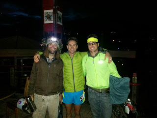
| Jason Schlarb, Birddog, and I at the finish of Run Rabbit Run |
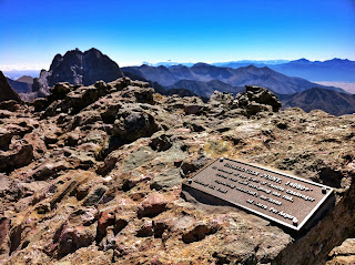
| Sweet quote on the trailhead sign for the Crestones |
 |
| First steps into the Sangre de Cristo's |
 |
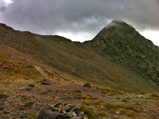
| Zero visibility above the ridgeline on the Crestones for my first day there... |
 |
| Snow and limited visibility on my second day there... |
 |
| On my third day I finally caught first glimpse of Crestone Needle |
 |
| The plains east of the Sangres were gracious enough to take all of the clouds for a few days of visibility in the mountains. |
 |
| Looking down a gully en route to Kit Carson |
 |
| On Kit Carson's summit with the Crestones over my shoulder |
 |
| Fun off-route down climb from Kit Carson. About 75'ish feet or so. |
 |
| Cruising along Kit Carson Avenue (the ledge seen in the photo) on my way to Challenger Point |
 |
| Summit of Challenger Point with Crestones to the left |
 |
| Kit Carson Avenue with Crestones front-and-center'ish |
 |
| View of the Crestones from Kit Carson. |
 |
| Bear's Playground (grassy area in the center), Humboldt to the left, and Crestones to the right |
 |
| Crestones with the South Colony Lakes |
 |
| Descending Crestone Needle |
 |
| Getting ready to get vertical on Crestone Peak. The route is straight up... |
 |
| Atop Crestone Peak with Northest Crestone over my shoulder. |
 |
| Northeast Crestone... |
 |
| South Colony Lakes and Humboldt (to the left) |
 |
| A view of the descent off Crestone Peak from the Red Notch at the top of the gully |
 |
| View of Kit Carson from Crestone Peak's Red Notch |
 |
| Heading back up-and-over Broken Hand Pass. Last obstacle of the day... |
 |
| Cottonwood Lake |
 |
| Cottonwood Lake again |
 |
| Rams or something. One of the fuckers charged me after an almost eight hour day in the mountains... |
 |
| Heading to the trailhead for Mount Lindsey |
 |
| Sunrise on the way to Mount Lindsey |
 |
| Same sunrise |
 |
| Taco Vision of the same sunrise |
 |
| Best sunrise photo I've ever taken, I think... |
 |
| Mount Lindsey ascent. Windy... |
 |
| On top of Mount Lindsey. More clothes in one 14er trip than I've probably wore on all previous 14er trips combined... |


