High in Colorado

High in Colorado
Photo: Mandy Lea Photo

Tuesday, August 27, 2013

Week in Review: August 19-25—Lacking Motivation


Monday, August 19th
OFF—After waking up pretty late with slightly sore legs and a little fatigue I decided to take an off day and do laundry. Laundry was much needed and it felt nice to take a REAL shower and put on CLEAN clothes afterward…

Tuesday, August 20th
OFF—Ben talked me into crashing another night at his place in Ridgway. So I figured if one rest day is good then two must be better (at least in moderation). 

Wednesday, August 21st
AM—11 Miles—2:39—3,400’—San Luis Peak (14,014’)
I wasn’t really feeling too motivated to get on this mountain today. Eventually, I headed out and fell into a power hike in no time. When I reached the three mile stretch on the Colorado Trail my legs finally decided to wake up and I cruised up to the summit effortlessly. I had some weird lightheaded feelings for the first thousand feet or so of descent, but they subsided as I got closer to the CT. I just coasted back to the Taco to put an end to a pretty blah day. The six total miles of runnable terrain on the CT was by far the highlight of the day. 

Thursday, August 22nd
AM—10 Miles—3:44—5,400’—Mount Shavano (14,229’), Tabeguache Peak (14,155’), Mount Shavano
Still unmotivated. I rolled out of bed for another late (8am) start up the mountains. The ascent of Shavano seemed to take everything I had just to top out in 1:44.At the summit I glanced down the mile of ridgeline that separated me from Tabeguache and felt a nice little burst of energy. I never ran any of the traverse, but had a definite pep in my step. The two-mile roundtrip traverse from Shavano to Tabeguache and back took about 55 minutes. Without lingering on my second summit of Shavano I dove into the descent at a casual pace taking about 1:04 to get back to the Taco in 3:44 roundtrip.  Although my legs felt like crap most of the day, I was pretty pleased with this time considering that when I did Shavano by itself on July 15th it was a 3:37 roundtrip time. It’s nice what an additional month of acclimation and fitness can do. 

Friday, August 23rd
AM—17 Miles—4:51—5,850’—Mount Massive Attack
I was pretty surprised that I was able to start at 6:30 this morning considering my week-long difficulties with getting out of bed. I still had motivational issues, but was able to shrug them off and hit the trail at a reasonable time. The trail up Mount Massive is pleasantly runnable to well above treeline. Just before reaching the saddle between South Massive and Mount Massive I veered off trail for a direct route up to the summit of the sub-14er South Massive. From there I headed northwest along the ridgeline tagging the summit of Mount Massive as well as the remaining sub-14ers: Massive Green, North Massive, and Point 14, 169 (Hunter-Fryingpan Wilderness HP). Tagging the five points above 14k feet was basically a casual meander on talus with the notable exception being the much-welcomed short sections of 3rd/4th class terrain I used to top North Massive. After hitting the summits I made my way back towards Mount Massive (where I chatted with a few stoners) to rejoin the main trail and begin my descent. I was pleased with how runnable trail was above treeline. Almost immediately upon hitting treeline the trail becomes cruiser singletrack back to the trailhead. So I did just that—I cruised back to the trailhead.
Summits of the day:
“South Massive” (14,132’)
Mount Massive (14,421’)
“Massive Green” (14,300’)
“North Massive” (14,340’)
“Point 14,169/Hunter-Fryingpan Wilderness HP” (14,169’)

Saturday, August 24th
AM—11 Miles—3:15—5,600’—Mount of the Holy Cross (14,005’)
Absolutely zero motivation to get out of bed this morning. I finally started moving with a bit of purpose around 7:45am and hit the trail shortly after 8am. Once I started moving my legs and mind both embraced the run and worked fairly well. I topped out on Half Moon Pass around 25 minutes, descended a thousand feet into the creek bed, then began the true ascent of Holy Cross. I basically put my down and charged up the mountain while trying to ignore all of the hikers and the two most popular questions of the day: “Where’s your water?” and “Training for something?”…Near the final summit pitch I just took a direct route and scrambled the boulders to reach the top in 1:45. Near the beginning of the descent I lost footing on a slabby rock and slid down a few feet before catching my left foot on the edge of a rock below to come to a stop. I felt a “pop” in my foot near the base of my big toe and just sort of shrugged it off as my joint popping. I took the rest of the descent pretty easy and got back to the Taco in 3:15. My foot hurt pretty bad the rest of the day.

Sunday, August 25th
AM—OFF—Preparing for my Nolan’s pacing duties tonight. I’m almost certain my foot is broken from yesterday’s slip on Holy Cross, but I told Ben I would join him through some night sections. I’m not about to let him down…So, I’m just going to pad my foot as much as possible and man-up to do my small part in helping out with this huge undertaking.
PM—OFF—Ben was running 3-4 hours behind coming into Clohesy Lake. So my pacing duties didn’t begin until after midnight. I tried to sleep a little, but it just wasn’t in the cards. 


Miles—49
Time—14 hours 31 minutes
Elevation Gain—20,250 feet


This ended up being a little unplanned recovery week—one that I likely really needed after two of the last three weeks being 30+ hour weeks. My legs were also a little sluggish after a big day in the Chicago Basin last Sunday. So, two days of R&R at Ben’s house in Ridgway were a little taste of heaven. 

Even after resting, motivation seemed to be my biggest struggle of the week with massive effort being needed just to get my ass out of bed…

My outings this week were used to finish off the last few 14ers I had remaining in the San Juans and Sawatch, which I did. Now, the only 14ers I have remaining in my summer project are the entire Elks and Sangres ranges. The current plan is to head out to the Elks tomorrow and have them completed by Sunday. Then I’ll spend a few days to a week in the Front Range playing around the Flatirons (Longs Peak too, maybe?) and getting some rest before venturing south to the Sangres, which should take 5-7 days to complete. I plan to be done with all of the Colorado 14ers by the second week of September. Hopefully I’ll have enough time to sneak in a trip to the Grand Tetons afterwards? Then I suppose I should stick a few days of tapering in there for The Bear on the27th                                              
  
Completion of the Sawatch Range 14ers has me feeling pretty excited to get back up high again in the Elks Range. This range will no doubt provide the stimulating technical terrain that I’ve come to love along with plenty of rotten rock. On Wednesday I’ll see if my first day out in the Elks is enough to restore some of that missing motivation. 

R&R in Ridgway

Summit of San Luis. My last San Juan 14er.

On the summit of San Luis

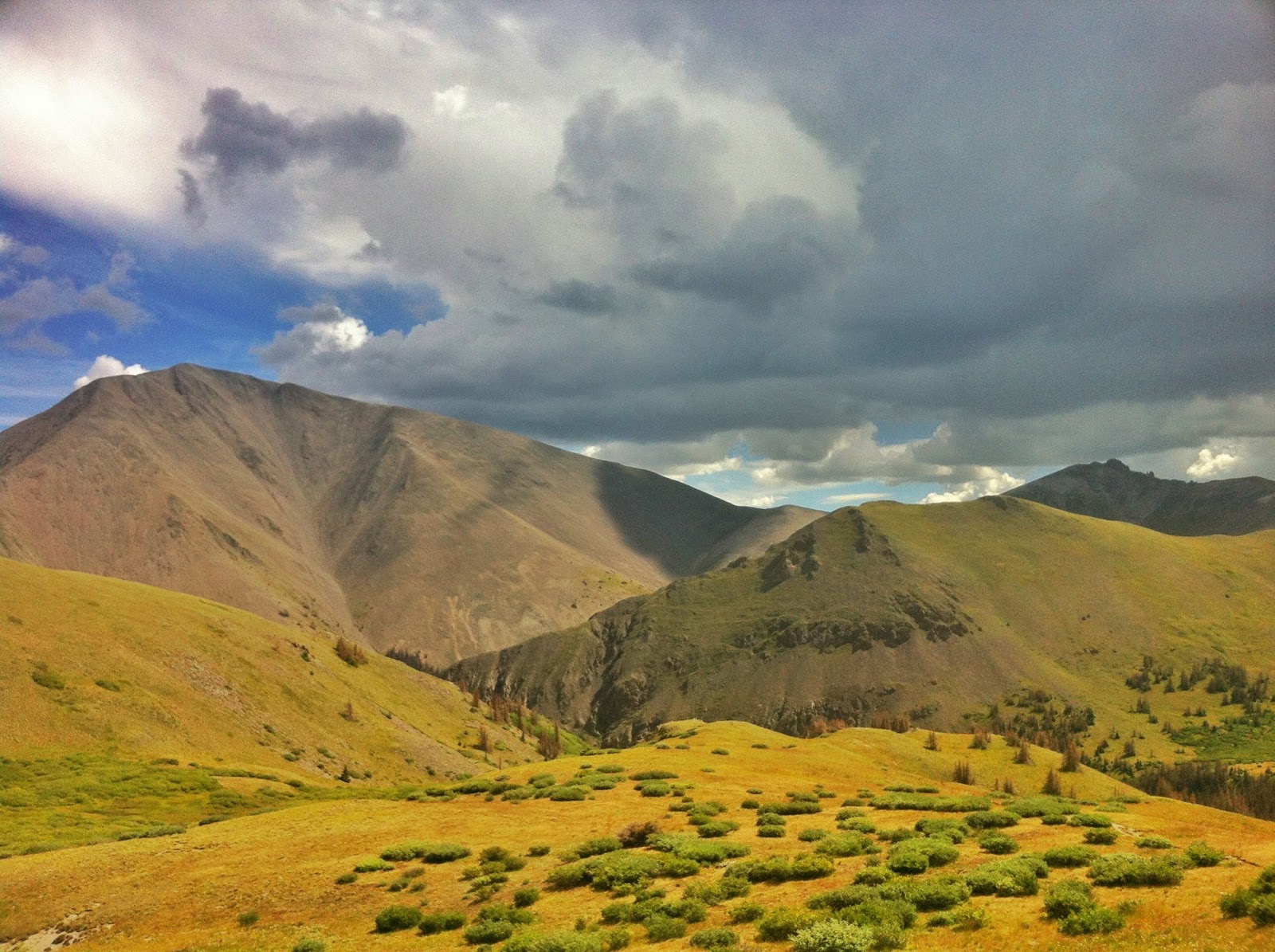
I got down from San Luis just as the afternoon storms were starting to build up

Plenty of sweet mining ruins on the drive from Creede to the trailhead for San Luis

Vegan dirtbag dining

Antero (I think) from the summit of Tabeguache

Low hanging clouds on the way up Massive

First glimpse of Holy Cross after getting over Half Moon Pass

Summit of Holy Cross in the distance

Fish Hatchery at 5am for the start for Ben's Nolan's 14 attempt

Sunrise over Leadville

Sunrise on Massive

Clear Creek Res. Waiting for my ride into Clohesy Lake to begin my nighttime pacing duties.

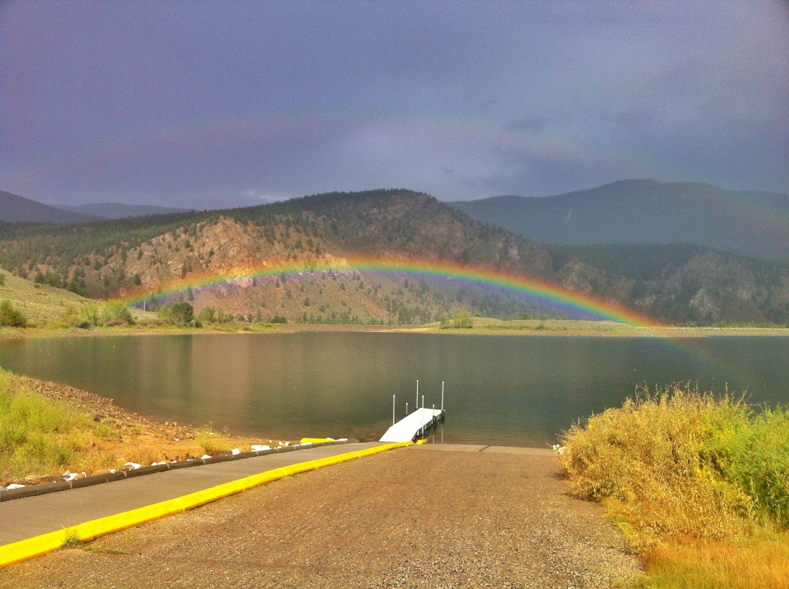
Sweet double rainbow at Clear Creek Res

Tuesday, August 20, 2013

Week in Review: August 12-18—Big Days in the ‘Juans


Monday, August 12th
AM—3 Miles—0:31—600’—Mill Creek Road
My legs were a bit tired and sore from TMR on Saturday. So, I just did an easy recovery run from the bottom of Mill Creek Road up to the gate for the water treatment plant and back down. Really mellow.

Tuesday, August 13th
AM—8 Miles—2:03—1,550’—Kilpacker Basin Approach
I suppose a little exhaustion finally caught up to me after capping off the last two reasonably high volume weeks with a 40 mile run at TMR. I slept in until 9 AM without waking up once. I haven’t done that in at least ten years. So, I ditched my plans to attack the Wilson Group and just scouted out the approach trail to El Diente. Another mellow day.

Wednesday, August 14th
AM—14 Miles—7:58—5,700’—El Diente (14,159’), “West Wilson” (14,100’), Mount Wilson (14,246’), and “South Wilson” (14,110’)
The intent was to knock out the entire Wilson Group in one go—two official 14ers, one unofficial 14er, and two 14er sub-peaks. I started early and disposed of the approach to El Diente pretty quick. The climb up El Diente went by fast with route finding never being an issue. The climbing was somewhat engaging in places but never difficult. I lost about 30 minutes in the initial descent from El Diente into the traverse to Mount Wilson. I somehow ended up in an area where I either kept getting cliffed out or confronted with exposed 5th class moves that had awkward entries I couldn’t really figure out. Finally, after snooping around a bit I found my ascent path and descended it to the low point of the ridge to begin traversing. With the exception of a few areas of loose talus I was pleasantly surprised with the solid rock on the ridgeline. At 1:40’ish, the traverse took about 25 minutes or so longer than I anticipated—likely the initial route finding errors. Eventually I popped around a corner to see two hikers with a priceless look on their faces. “Where the hell did you come from?” was a logical question when a half-naked guy comes out of nowhere on the mountain right before the last summit pitch. They seemed reluctant to begin the last pitch so I just jumped on, started climbing, and was on the summit in no time. In an effort to avoid what looked like a ridiculous downclimb on the ridge to South Wilson, I dropped down a considerable amount before beginning an ascending traverse towards the South Wilson summit. Nothing about the climb up to this sub-14er was good with the exception of the view from the summit. Steep, loose talus eventually gave way to steep 4th/low-5th class climbing on super shitty, rotten rock which continued pretty much all the way up to the summit. At one point, I pulled a chunk of rock loose the size of my torso and watched it go tumbling down the mountain. After what seemed like forever, my stupidity paid off and I was on the summit of South Wilson. I found a gully not far from the summit that descended in a nearly straight line down the face of the mountain all the way to the shitty talus field lining the bottom of the basin. This gully was full of loose rock (surprise, surprise) which I continually had to worry about due to the narrow gully serving as a funnel for falling rocks. After reaching the talus fields I began a death march back to treeline where I knew almost 4 miles of runnable terrain awaited. Sometimes I take for granted how good it feels to just run. Six hours of technical terrain, rotten rock, and talus hopping makes me remember real quick.

Thursday, August 15th
AM—9 Miles—4:04—3,700’—Wilson Peak (14,017’)
I started around 8AM from the Rock of Ages Trailhead. The trail was pretty unspectacular from the TH to the Rock of Ages Saddle—boring singletrack and talus’y roads that made my ankle tremble at the thought of running. So, I hiked up from the moment I hit the talus until I reached the summit with the few exceptions being the short sections of climbing. From the small saddle at 13,260’ I just started climbing above the route through some shitty, loose 3rd/4th class terrain with the hopes that the route would actually go and I wouldn’t have to downclimb. It went. I basically tried getting to the summit with as much scrambling and as little hiking possible to keep it fun. I walked pretty much the entire descent due to the never-ending talus.

Friday, August 16th
AM—9 Miles—2:38—4,600’—Handies Peak (14,048’)
After sleeping in downtown Ouray I headed up the hill intending to go to the American Basin Trailhead via County Road 18 (Alpine Loop?). One mile and 30 minutes later I said “fuck it” and turned around. The road sucked. A lot. So, I went to Silverton and made my way to the Grouse Gulch TH, which added about 3 miles or so to my run. I was surprised at how runnable Handies is. Even the climb up from Grouse is switchbacked enough to make the entire thing runnable. That being said, my legs felt pretty shitty so I didn’t push terribly hard on the ascent and found myself even hiking a good portion of the runnable terrain. I eventually topped out in 1:30, chatted with some people on the summit, then made my way back down. Of course, I decided to venture off trail a bit and ended up going pretty slow while descending a steep, grassy, rocky mix of a slope. Pretty hot day up high. After a couple days of more technical routes this route seemed a bit boring. I did appreciate the noticeable lack of talus, though…

Saturday, August 17th
OFF—I originally planned a quick and easy morning summit of Kendall Mountain in Silverton, but decided against it since Kendall isn’t a particularly stunning mountain. I figured a rest day with lots of calories would better serve me for Sunday’s Chicago Basin outing…

Sunday, August 18th
AM—40 Miles—14:45—11,200’—Chicago Basin 14ers: North Eolus (14,039’), Mount Eolus (14,084’), Sunlight Peak (14,059’), and Windom Peak(14,087’)
In an effort to expedite completion of the San Juan 14ers I decided to tackle the Chicago Basin group in one go. Even with a 3:15 AM start from the Purgatory TH it was hot as hell outside. I started shirtless and remained that way for all but 45 minutes of the day. The 15-mile approach to the Twin Lakes trail junction went by effortlessly, though not as quick as I had hoped—3:39. On the approach I realized that this was only the second night run I’ve done in the last two years or so. Sure I’ve ran for 30 minutes or so in the dark before day break, but I haven’t really spent multiple hours running in the dark. So I pussyfooted along trying not to roll my ankle again. The short climb up to the Twin Lakes Basin provided the first obstacle of the day—goddamn mountain goats. On this short stretch I saw no less than ten mountain goats and some of them were quite aggressive. I tried to go off trail and sneak around but there were two of them that kept cutting me off, lowering their head like they would charge, and stalking me. Eventually, I got around the goats and up to the basin with about 30 minutes of lost time attributed to “wildlife encounters and evasions.” Not too far into my ascent of Mount Eolus I decided to put my head down and take a more vertical route up the mountain versus following cairns that seemed to meander around a series of grassy ledges. In doing this, I realized that I was basically already at the summit of North Eolus and went ahead to tag it in 5:04. The traverse over to Mount Eolus was ridiculously easy. The Catwalk was more of a Cakewalk with essentially no exposure on either side (don’t listen to what casual hikers may try to tell you about this section being scary or exposed). After taking it easy on the traverse, taking numerous photos, and stopping to peek over the edge at the “exposure” I reached Mount Eolus in 5:21—a 17 minute casual traverse. The descent from Mount Eolus is where my second big chunk of lost time came from—about another 45 minutes. I opted for a straight down route on the descent off Mount Eolus, which resulted in numerous cliff-outs and 4th/5th class downclimbs. After poking my head around a bit I ended up downclimbing some somewhat steep slabs that dropped me into what I think was the bottom of the East Couloir (who knows, really?). A little talus was all that remained between me and Twin Lakes, which I reached in 6:32—ugh. Next up was Sunlight Peak. The cairned route seemed to follow some loose dirt/scree as it headed up to the summit. Usually this terrain isn’t a problem, but I was wearing some La Sportiva approach’y shoes that have crap for traction on this terrain. So I took a route that was more boulder hopping, scrambling, and easy climbing until reaching the ridge and re-joining the standard South Slopes route to the summit. Along the way, it began to rain enough to get the rocks near the summit wet. I spent about 15 minutes playing around the final summit blocks and even toyed around with the idea of going barefoot to the summit. Just as I was getting ready to turn back without summiting, the sun came out and the rain stopped. So, I waited around another 15-20 minutes to see how the sun would dry the rock. Fortunately, the rock dried super fast. So, I shimmied up a crack in the lower of the summit blocks before taking a few leaps of faith to reach the summit in 7:56. I descended down a route of my own in efforts to avoid the scree/talus crap and stay on bigger rocks with more traction. Ignoring the easy trip over to Mount Eolus from North Eolus, the ascent up Windom proved to be the easiest of the day. I didn’t mind this—I had already been moving for 8 hours on nothing more than one VFuel gel and three handheld bottles of water. Again, I chose a more direct route up to the summit. This route tended to be primarily broken sections of slabby’ish climbing that made for a somewhat quick ascent. I reached the summit of Windom, my last of the day, in 8:52. Great! Now all I had to do was get back to the Twin Lakes Junction and cover 15 miles back to the Purgatory Trailhead. This turned out to be much easier said than done. Once I reached some runnable terrain near Twin Lakes I fully noticed just how bad my feet hurt. I had already gone ten miles further in the La Sportiva’s than I’d ever gone and I still had 15 more miles to go. My feet hurt all over and my Achilles’ felt destroyed. Maybe wearing an approach shoe for only ~10 miles of somewhat technical terrain when you have ~30 miles of actual trail running was a bad idea? I hobbled down to Twin Lakes in 10:02 and then walked pretty much every step of the way back to Purgatory for a 14:45 finish. Ugh...The 15 mile return to Purgatory gave me mixed feelings at the time. On one hand, I got to see all of the amazing scenery that I could only imagine on the approach due to the darkness. On the other hand, I had to walk 15 fucking miles back to the Taco and it was hot as shit! Oh well, it was still an amazing day in the mountains and likely one of my Top 5 Most Scenic Runs Ever. If you’ve followed this blog at all you’d realize that I’ve ran in some pretty amazing places…


Miles—84
Time—32 hours 2 minutes
Elevation Gain—27,350 feet                                                               


After the Telluride Mountain Run I gave myself a couple of easy days to rest and recover. Turned out, I was pretty friggin’ tired. After some R&R, I set out on a mission to knock out all of the 14ers in the San Juans this week. I almost got them all. I’ll bag San Luis on my way back to the Sawatch and then the San Juans will officially be DONE. 

This was a great week for me. I sought out more technical routes on some already somewhat-technical mountains, which contributed a great deal to my overall time-on-feet. The main goal was to just get some practice with exposed 3rd/4th/5th class scrambling, especially on the loose, rotten rock of the Wilson Group. After that shit show I was happy-as-can-be to scramble around on the super solid rock of the Chicago Basin group without giving much thought to my hand/foot placements. 

The coming week promises to be great as well. I’ll wrap up the Sawatch Range 14ers with Tabeguache, Massive, and Holy Cross. At the end of the week I’ll be helping my buddy Ben with his Nolan’s 14 attempt. As of now, it seems that I’ll be joining him from Clohesy Lake to the North Cottonwood Trailhead—20’ish miles and 9k feet of climbing to hit the summits of Missouri, Belford, Oxford, Harvard, and Columbia (at least I think that’s what Ben told me). However, plans aren’t finalized yet. Regardless, even if I don’t get out on any of the summits with Ben I’ll be stoked just to help him out in this huge effort. We did joke a little this morning about me joining him for the entire attempt. If he’s even remotely serious then I could very easily be persuaded to join…

My running-shoe-clad-climbing confidence is increasing faster than I could have imagined. This has me eager to wrap up my 14er project ASAP so that I have a few more weeks of summer to explore some more exciting, technical routes in the mountains. I’m currently projecting to wrap up the Colorado 14ers in the second week of September with the Sangres. As always, we’ll see how it all goes…


Oh, I also signed up for the Bear 100 Miler sometime in the last week or two. I’m not really sure that I want to run another 100 miler, but this is a qualifying race for the Hardrock 100. Hardrock is pretty much the only 100 on my bucket list…

Some relaxation in Telluride after TMR

Camping at the trailhead the night before hitting the Wilson Group.

The approach up to El Diente

Getting pretty close to the summit of El Diente

View of the traverse from El Diente to Mount Wilson. Taken from South Wilson.

My descent from South Wilson. What a shit show...

Driving to the Rock of Ages trailhead to hit Wilson Peak
View of the El Diente to Mount Wilson traverse. Taken from Wilson Peak.
Summit shot on Wilson Peak with the El Diente to Mount Wilson Traverse in the background.
This is what fuels most of my runs...It's also a great recovery drink!

Cruiser trail up to the summit of Handies.

Summit shot on Handies.

A rather unassuming start to one of the best routes I've done in Colorado yet.

A look at the infamous Catwalk from North Eolus up to the summit of Mount Eolus...

Me scrambling up to the summit of Mount Eolus. Look closely and I'm in there...

Some rain moving in as I neared the top of Sunlight.

Looking towards Windom from the summit of Sunlight.

Coming down from Windom after a long day in Chicago Basin. Still had over 15 miles to get back to the Taco...