High in Colorado

High in Colorado
Photo: Mandy Lea Photo

Monday, November 19, 2012

Week in Review: November 12-18


Monday, November 12th
AM—None
PM—10 Miles—1:51—2,000’—McDowell Sonoran Preserve near Phoenix, AZ
Loop run on Gateway, Windgate, and Bell trails. Legs felt unbelievably horrendous on this “run” around the Preserve. Much like the Pass Mountain 50K a few days prior my legs only felt somewhat decent on the climbs. The descents were downright painful. Pretty scenery almost made up for the obscene amount of rude hikers on the trail. Almost…

Tuesday, November 13th
AM—11 Miles—2:00—2,000’—McDowell Sonoran Preserve
Loop run on the Desert Park, Windgate, Bell, and Gateway trails. This was another easy run without ever pushing beyond the most relaxed conversational pace imaginable. My legs are still a little sore, but they seem to be getting better now.
PM—None

Wednesday, November 14th  
AM—None
PM—16 Miles—2:50—2,200’—Creepy Balloon Animal Guy Loop in Sedona, AZ
Pretty awesome lollipop run on Brins Mesa, FR152, Secret Canyon, David Miller, Bear Sign, FR152, and Brins Mesa trails. This run was suggested by the fine people at the Sedona Running Company. These people are great at recommending trail runs for just about any distance and will even print you a map! This was a pretty mellow run, which was fine with me since my legs still feel pretty crappy (although significantly better than yesterday). I was pretty surprised at the range of running surfaces experienced in such a short run—everything from typical desert slickrock and washes to heavily forested areas with trees covered in rocks, roots, and tree leaves. Pretty fun run. This was another run where I basically just took it easy and enjoyed the views.

Thursday, November 15th  
AM—8 Miles—1:04—700’—Chuck Wagon/Long Canyon/Deadman’s Pass/Mescal Loop
I asked Adam at Sedona Running Company for a nice little 5-10 miler for my morning shakeout run and this is what he suggested. The run was pretty mellow with a few gradual climbs that were more or less over before they started. My hamstrings started out fairly tight so I took the first 2 miles super easy. Eventually I warmed up and started to run a little quicker than planned on the super-runnable trails. The few semi-technical rocky sections always hit at the right places in the run—some nice little downhills that let me practice my footwork. The Mescal Trail was pretty awesome running. Although it was flat-as-can-be it offered some spectacular views and fun running along some of the most enjoyable slickrock trail I’ve ever ran.
PM—None

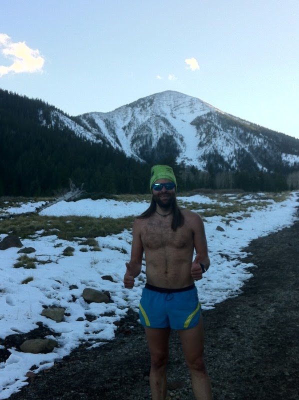
Friday, November 16th  
AM—22 Miles—6:08—2,600’—Hot Loop/Jacks Canyon Loop in Sedona, AZ
Horrible run recommendation. At all times the trails were either super technical, horrendously sandy, overgrown with plants that draw blood, nearly non-existent, poorly marked, covered in cow crap, had seemingly endless offshoots/social trails, or some combination of these. Not very pleasant at all. About an hour in I gave up all hope of actually running and decided to hike the rest of the route. 
PM—None

Saturday, November 17th         
AM—None
PM—11 Miles—2:19—1,700’—Elephant Hill/Chesler Park/Joint Trail in Canyonlands National Park
This run was recommended to me by JV. I did part of the run about a month or so ago, but my legs felt too crappy to do the full thing. Even on this run I still didn’t do the full recommendation from JV as I cut out the four mile out-and-back to Druid Arch. I ran into Tom Masterson about 20 minutes or so in and talked a little longer than I had planned (worth it, though). So a little later in the run I noticed that the sun would be behind the rock formations before too long and things might get a little frigid without a shirt on. Overall gorgeous run which words can’t describe. So the photos below will hopefully do some justice…I forgot to stop my watch during photographs, etc. so the pace comes out a little slow.

Sunday, November 18th  
AM—None
PM—5 
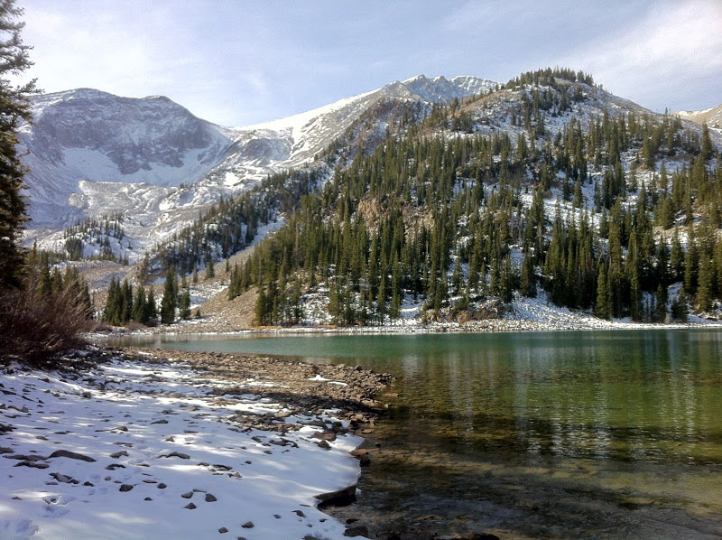
Miles—1:11—2,400’—Green Mountain
Started the morning out in Indian Creek, Utah and ended up in Boulder, CO about 8 hours later. First stop was the Gregory Canyon TH to wake the legs up. As soon as I approached the trail to begin the outing I noticed JV pulling into the parking lot. So we made our way up the front side of Green and down the back side. I felt like shit and was out of breath pretty much the entire way up. He was not trying. The descent was pretty fun; enough ambient light to see where you’re going, but not enough to put 100% confidence in each step. It’s always great to get out and run with Jeff. He’s definitely one of the best runners in town so it’s a privilege to have him slow down his pace enough to let you kind of keep up.

Miles—83
Time—17hours 25minutes
Elevation Gain—13,600 feet 
                                                                                                     

Not really anything insightful to say about this week. This was not a particularly good week of running. My legs felt like crap for most of the week so I just took slow, casual approaches to all of the runs and avoided my usual long run of ~30ish miles or so. Thursday’s run stands out as the best performance of the week. All of the runs except for Friday’s stand out in terms of scenery (Green Mountain in Boulder never gets old). 

I'm hoping to get in a few solid runs during my days in Boulder prior to the Thanksgiving holiday. We'll see how it all plays out...
How I felt on my runs in the McDowell Sonoran Preserve with all of the snooty trophy wives
Blowing out the upper on my 110's running in Sedona, AZ


Elephant Hill in Canyonlands National Park

Chesler Park Loop in Canyonlands

Chesler Park Loop

Chesler Park Loop

Looking up from the bottom of a slot canyon on the Joint Trail in Canyonlands NP

Meandering through a slot canyon on the Joint Trail

These slot canyons get a little narrow in some places. Sunglasses and shaved legs just for Rob Timko.

View after emerging from the slot canyons on the Joint Trail

Monday, November 12, 2012

Week in Review: November 5-11


Monday, November 5th
AM—None
PM—3 Miles—0:31—1,100’—South Kaibab Trail to Cedar Point
After driving all day from Moab to the Grand Canyon I almost opted to not even run. However, it’s hard to go to the South Kaibab TH and not be inspired. So I decided on a dinky little three mile out-and-back to Cedar Point to shake out my legs after the long drive.

Tuesday, November 6th
AM—28 Miles—5:40—6,400’—South Kaibab Trail to Cottonwood Campground (Bailed R2R2R Attempt)
I knew that my R2R2R attempt would either be Tuesday or Wednesday. When I woke to unusually warm temperatures on the South Rim I knew Tuesday would be the day. So I crammed some Vi’s in my pockets, filled my handhelds, and took off. A prescribed burn on the North Rim led to unbearable smoke. By the time I reached Cottonwood Campground on the North Kaibab I just couldn’t take it any longer. Full account will be posted later.
PM—None

Wednesday, November 7th
AM—20 Miles—4:32—4,800’—Down South Kaibab and Up Bright Angel
Since I was 14 miles and 5,000 feet of vertical short of my previous day R2R2R goal I still had a little left in the legs. So I decided to head down South Kaibab and back up Bright Angel where I would take the Rim Trail back to El Taco Blanco at the South Kaibab TH. Needless to say, I sure surprised the hell out of people who had seen me at the bottom of the Canyon on Tuesday’s run…
PM—None

Thursday, November 8th
AM—None
PM—5 Miles—0:37—300’—Rim Trail
Legs felt destroyed. So I decided on a little run on the flat Rim Trail just to fully assess how destroyed they were. The few rollers on the trail (especially anything downhill) was almost too much to handle. I guess three days in a row of pounding descents on South Kaibab will do that.

Friday, November 9th
AM—None
PM—None

Saturday, November 10th        
AM—31 Miles—4:47—2,400’—Pass Mountain 50K in Mesa, AZ
With the threat of cold, nasty, snowy weather rolling into the South Rim I decided to migrate south towards Phoenix. I found the Pass Mountain 50K race and decided that if my legs came around I would run it. The race allowed for race day entries so I had right up to the last minute to make up my mind. My legs didn’t feel good race morning, but they felt good enough. So I ran…I ran slow…But I had fun at the same time and that’s what really counts.
PM—None

Sunday, November 11th
AM—None
PM—None

Miles—87
Time—16hours 9minutes
Elevation Gain—15,000 feet                                                                                                     

This week was a bit strange…Somehow it evolved from intentions of R2R2R in the Grand Canyon to “racing” a 50k in Mesa, AZ on a whim. How the hell did that happen? Just goes to show that you can never really plan anything. When you live in your truck, don’t work, and have no particular place to be on any particular day this rings more true. Admittedly, I love the spontaneous nature of the life I’ve been leading the past few months. “No plan” most definitely IS a plan. 

I was rather pleased with the beating my legs endured this week and the minimal—relatively speaking—fatigue that resulted from multiple pounding descents down the South Rim of the Canyon. Perhaps more pleasing was being able to run an above-average 50k “race” after inflicting this punishment on myself. I put quotation marks around the word race because with the exception of the first five miles or so I was never in a 50k race pace—it was more like a 50 mile race pace. My legs wouldn’t have been able to handle it at all. 

I’ve decided to try to sneak in the McDowell Mountain Frenzy 50 Mile race on December 8th before I head down to South America. This is another race put on by the guys with Aravaipa Running: Jamil and Nick. I don’t know much (well, anything) about race directing, but these guys certainly seem to know what they’re doing. So, I’m pretty excited to get out to the Phoenix area in a month or so and run another one of their races…
Smokey view from the South Kaibab TH parking lot
Usery Mountain Regional Park in Mesa, AZ
Quick start at the Pass Mountain 50K--Photo by Nick Coury
Sunrise in the desert

Random Running Photos--Carbondale, CO and Moab, UT

Here's a collection of random photos from some of my runs over the past few weeks. Enjoy!
Mount Sopras near Carbondale, CO

Mount Sopras

Trans La Sal Trail near Moab, UT. Hard to believe the desert is only ~15 minutes away...

Negro Bill Canyon near Moab, UT

Morning Glory Natural Bridge near Moab, UT

Hidden Valley Trail near Moab, UT

Hidden Valley Trail

View of the La Sals from Hidden Valley Trail

Sunset at Shay Mountain near Monticello, UT

Sunday, November 11, 2012

Back to The Creek: More Climbing and Running

After an easy go at the Grand Canyon Rim2Rim2Rim I returned back to Indian Creek to meet up with Alex and others for more climbing (and running, of course). Here are some photos...
Alex belaying the shit out of Vince

Working on my tan in The Creek

Sunset during an easy run on the Slickrock Trail in Canyonlands NP

Empties

View of the La Sals in the distance

Passing through an arch on a run to the confluence of the Colorado and Green Rivers

Confluence Overlook--Where the Colorado and Green meet

Partial run of a loop recommended by JV in Canyonlands NP

More of the JV run

Still the JV run...

There was a lot of cool stuff to photograph on the JV run

JV said "make sure to bring your camera for this run"

Last of the JV run pics...

Some pretty desert colors

Saturday, November 3, 2012

Getting High in Arizona—Mount Humphrey’s and the Inner Basin


After almost a week in Indian Creek perfecting my crack flailing abilities I decided to head down to the Grand Canyon for a Rim-to-Rim-to-Rim effort. I headed south on a Saturday with no real knowledge of the area surrounding the Canyon. So, I decided to settle down in Flagstaff for the night until I could get on the internet and find places to car camp near the GC. 

Just outside of Flagstaff a turnoff for national forest access presented itself, which naturally begged to be explored. Eventually I found a road that dead-ended at a trailhead for the Inner Basin Loop. After six hours of driving the Taco stand a run sounded both wonderfully appealing and hauntingly appalling. So I ran…

The temperature was nice and cool, but felt warm enough to justify running sans shirt (at least until 15 minutes into the run when the sun fell below the mountains). Regardless, I still maintained the casual pace I intended. I was rewarded with a few stunning views of the turning Aspens as well as decent views of some of the San Francisco peaks once I reached the Inner Basin. A nice-and-easy 5 mile run with 1,100 feet of vertical in 54 minutes. Not too shabby for just hopping out of the Taco after driving for six hours…
Aspens!!!

My dumb ass in the cold all in a desperate attempt to annoy Rob Timko. Just wish my head wrap had an upside-down visor on it...

Chilly running conditions

A nice sunset on the way down from the trailhead
After dinner and beer at some unmemorable brewery in downtown Flagstaff (what can I say? Colorado breweries have spoiled me…) I parked El Taco Blanco in the Motel 6 parking lot and had one of the most uncomfortable nights of sleep I’ve had in a LONG time. 

Some early morning research (and napping) at a local coffee shop had me ready to go tackle Mount Humphrey’s—the highest point in Arizona at 12,633 feet or something like that. When I rolled into the parking lot of the Arizona Snow Bowl and began changing into running clothes the stares began. Most noticeable was a couple standing by some table near the TH. I assumed they were going to ask me to register to vote or something so I avoided eye contact like the plague. Turns out they were doctors conducting research on the effects of altitude on hikers up Mount Humphreys.
Driving along Kendrick Street to get to the Humphrey's trailhead
The docs seemed a bit surprised when I told them of my plans to run up the mountain and be at the top in the one to one-and-a-half hour range depending on how bad the snow was. I was the 16th person to sign up for the study with person #1 having about a three hour head start. My goal was to be every last one of them to the top. 

I took off at a comfortable yet decent pace up the super runnable grade—stopping to talk to anyone who felt like talking along the way. About a mile or so into the 5 mile ascent the trail started getting snowy/slushy/icy. Near the saddle the snow was deep and soft enough that I either kept falling through the snow pack or couldn’t get traction. So I fell into an easy power hike for most of the remainder of the ascent with the exception of the last ¼ to ½ mile, which I ran pretty hard. I topped out around 1:30 and was immediately hooked up to the doctor’s machine to be tested.  Not really sure what all the machine told him (O2 saturation, heart rate, other things?), but my heart rate dropped from 150 to 70 within one minute of topping out. The doc seemed impressed. Maybe it was my heart rate or maybe it was the fact that I beat everyone except the #1 person in the test to the top. Number 1 beat me by less than five minutes. That bastard…
First glimpse of the Mount Humphrey's summit (far right) and several false summits along the way

Mount Humphrey's summit post

Looking back at the path I took up to the summit
The descent was pretty much an uncontrolled glissade through slush—hoping and praying that I didn’t fall and crack my head open on one of the many exposed rocks. Really fun stuff. For some reason I got a lot of weird looks while doing this…

After a few more miles of slipping and sliding I eventually hit some rooty (but runnable) terrain, which I coasted on back to the trailhead for my last round of doctor testing. I finished the 10 miles with 3,300 feet of vertical run in 2:53. Really mellow, but not bad considering how much snow was out there and that I was running in it with essentially no traction at all—the 110’s I was wearing had 500+ miles on them and not much tread left. I would love to go back and run Humphrey’s without snow since it’s such a mellow grade. 

With my legs sufficiently warmed up I decided to Taco camp off a forest service road in Tusayan to get into the Grand Canyon park gates early and avoid paying the entry fee.