High in Colorado

High in Colorado
Photo: Mandy Lea Photo

Sunday, August 7, 2016

Longs Peak Project (July) -- A Walk in the Park


July 9th—A Walk in the Park (Glacier Gorge Traverse) with Peter Bakwin.

Half > Storm > Longs Peak (via Keyhole Ridge) > Pagoda > Chief’s Head > McHenry’s > Powell > Thatchtop

Car-to-car time: 10 hours 53 minutes

I definitely rank this right up there as one of the best days I’ve ever had in the mountains. Such a great route! Peter and I hit the trail hiking at first light and found ourselves ‘schwacking up Half in no time. As Peter recalled, we were dead even on his previous splits for Half and Storm when he did this route with Buzz and Tina previously. Everything up to the Keyhole was pretty chill 2nd Class terrain.

The real fun began once we reached the end of the mellow ramp at the beginning of the Keyhole Ridge route. Here, we began a steep ascent of a flake/crack system for what felt like 100’ish feet. The scrambling was fairly steep and exposed, but solid. Once we reached the top the terrain eased for a bit. I probably should have done this write-up shortly after completing the route since I don’t really remember too many details almost one month later. I do remember a super exposed side traverse on small ledges to skirt around one of the more vertical cruxes. I also remember an awkward step around a corner (right by the off-width crack) that led to a 10-15 foot 5.6 cruxy section on solid holds. This step around and 5.6 section was spectacularly exposed, much like most of this route. Eventually, the difficult terrain relents into a 2nd/3rd Class hike to the summit.  

From the summit of Longs we headed down the Homestretch for a short while before veering off and heading towards Pagoda. The key to the descent to the Longs-Pagoda saddle is finding a break in the cliff band that allows for an easy descent. We found this easily and trudged up to the summit of Pagoda rather quickly.

Next, was the second crux of the day—the descent off Pagoda. If you have a rope to rappel or you’re a more ballsy solo downclimber than Peter or I then you can just downclimb the 5.7 west ridge of Pagoda. Otherwise, you can sneak and meander your way down through a series of low-5th Class downclimbs and ledges. We opted for the easier descent. The route finding on this descent option isn’t obvious, but isn’t terribly difficult either. Once through the difficulties we found ourselves on a nice ledge over to Chief’s Head.

From Chief’s Head to McHenry’s was pretty easy, straightforward terrain. A chilly wind picked up around this point and lingered until we began our descent off Thatchtop. Everything we had read about the descent into McHenry’s Notch had us prepared for another cruxy part of the day. However, we managed to find our way down into the Notch without ever exceeding 4th Class.

McHenry’s to Powell was another cruiser section. From Powell to Thatchtop was quite enjoyable 3rd/4th Class terrain that kept us engaged enough to forget that we had been on our feet for over eight hours. The only negative about this stretch was that it proved to be pretty slow going due to a knife-edge traverse, several slabby downclimbs, and a couple of lichen-covered sections.

Once on Thatchtop we were left with a talus hopping descent down to Solitude and Shelf Lakes, which passed by quickly. The worse part of the final descent was the section from Shelf Lake to the main trail running along Mills Lake and back to the trailhead. This was steep, loose, and covered in downed trees, which sucked to run down in dot rubber approach shoes.

When we finally reached the main trail we just ignored how tired we were and ran all the way back to the trailhead. We wanted to see if we could finish in under 11 hours, but mostly we just didn’t want the last few miles to drag on forever because we were being lazy and walking. We ended up reaching the trailhead in 10 hours 53 minutes and felt satisfied with our effort.

It felt good to be back at the car and to get the shoes/socks off. It felt great to stop at Oskar Blue’s for food and beer on the way back home. It felt even better to get back to the Taco and pass out for a few hour nap.

Splits: Total time (split time)
Half—1:13 (1:13)
Storm—2:30 (1:17)
Longs—4:00 (1:30)
Pagoda—4:43 (0:43)
Chief’s Head—6:04 (1:21)
McHenry’s—7:15 (1:11)
Powell—8:00 (0:45)
Thatchtop—9:20 (1:20)
Trailhead—10:53 (1:33)

The route--going clockwise
Peter leading the way at sunrise

On the summit of Storm with a glimpse out what awaits us for the rest of the day

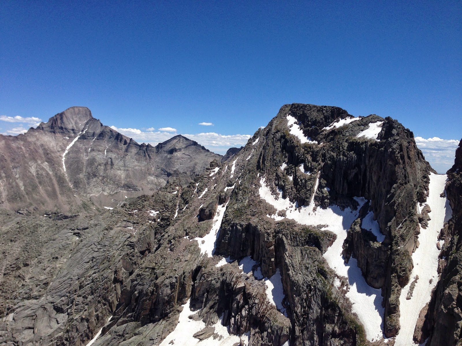
Coming off of Half and catching our first views of Keyhole Ridge up Longs Peak

Unobstructed view of Keyhole Ridge. Such a sweet route!

Keyhole Ridge starts out easy enough on this ramp

Then escalates rather quickly on this steep scramble up a flake/crack system (Photo: Peter Bakwin)

This is a short 10-15 foot 5.6'ish crux section right after an awkward step around a corner. Both are very exposed. (Photo: Peter Bakwin)

Look closely and you can see Peter making his way up the huge ramp.

Embracing the exposure on this side traverse (Photo: Peter Bakwin)

Looking down is fun (Photo: Peter Bakwin)

Peter making his way to Pagoda, I think

I think this is on the descent of Pagoda, but I can't remember

One of the 5.easy sections of the Pagoda downclimb (Photo: Peter Bakwin)

The sweet ledge system from Pagoda to Chief's Head

Making my way across the nice, big ledges (Photo: Peter Bakwin)

Looking back at Pagoda. If you look closely on the right side of the ridge you can see the grassy ledges that we used for the downclimb.

Just a small taste of the route

Peter making his way into McHenry's Notch, I think

The knife-edge between Powell and Thatchtop

Peter on the knife-edge

Looking back on our route from the knife-edge

Me on the knife-edge

A fun finger crack/dihedral downclimb

Panorama of our route from the last summit of the day, Thatchtop
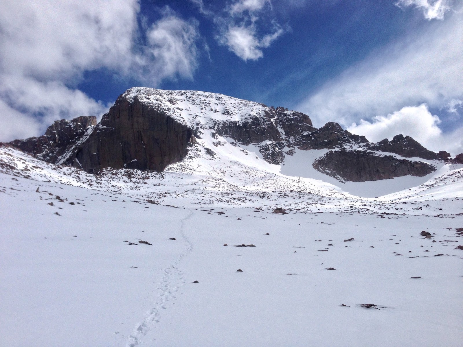
View from Thatchtop

Longs Peak Project (June) -- Kieners


June 25th—Ascended Kieners, descended North Face with John Greedy

This ascent went a lot smoother with the route fresh on my mind. John hadn’t been up Longs in several years. So, his stoke was pretty high. We made good time up to Lamb’s Slide where we put on crampons and got out our axes. There were a few groups above us so I hauled ass to try to get to the top before they started the traverse over to Broadway and knocked rocks down on my helmetless head. John had a helmet so I didn’t feel too bad dropping him here. The few snow spots that were on Broadway last week had all melted leaving Broadway a cruiser alpine sidewalk. We quickly made our way through the short crux sections of lower Kieners and found ourselves on mellow terrain in no time. We actually stayed on route for upper Kiener’s, which made for a much more pleasant experience compared to last week. We spent almost an hour on the summit chatting with Peter Bakwin (who had ascended Keyhole Ridge) and a few others before making our way down the North Face waterfall route. After 8 hours 4 minutes we found ourselves back at the trailhead enjoying a few beers. 

Our route: Up Lamb's Slide, traverse Broadway, up Kiener's

Sunrise above treeline

Longs Peak in the distance

Pretty awesome place to be

Skirting around Chasm Lake (Photo: John Greedy)

Looking up at Lamb's Slide and all of the people that will be potentially knocking rocks on us from above once they start the entry to Broadway (Photo: John Greedy)

Getting ready to shimmy up Lamb's Slide (Photo: John Greedy)

John heading up Lamb's Slide

Pulling around the crux bulge on Broadway (Photo: John Greedy)

John Greedy making his way across Broadway

Cruising up the easier upper Kiener's route (Photo: John Greedy)

John on upper Kiener's

Loitering on the summit for over an hour. Hard to beat weather like this at 14,000+ feet! (Photo: John Greedy)

Looking back at the descent.

June 19th—Ascended Kieners, descended North Face with Derrick Clemmenson

I had only done Kieners once prior to this and it was almost a year ago. So, my knowledge of the route was very limited. However, I did at least know where the start was. Derrick and I made good time up to Broadway where we removed our crampons and stowed our axes. There were a few patches of avoidable snow and the snow that was above the ledge had frozen ice axe holes in it, which provided great hand holds. When we reached the Notch Couloir there were two climbers hanging out and belaying a lead climber who was heading up Kieners. Those guys didn’t seem too thrilled to see two guys in running shoes come past them with intentions of soloing the route they were pitching out. Fortunately, the lead climber was much nicer and let us pass quickly. After scrambling through some of the crux section we found ourselves in some sort of gully that appeared to have two exits: one directly to our right and one straight ahead. The footprints in the snow led us to believe that straight was the correct way. So, I scrambled up and some stuff that felt a little harder than 5.4 and noticed several pieces of webbing along the way. I should have realized that these were likely for parties that bailed out, but I didn’t. I eventually topped out and noticed that the exit was going directly into Notch Couloir. After downclimbing a bit I made my way back to our second route choice, the one of the climber’s right, and we easily exited the gully onto cruiser terrain. The rest of the ascent was harder than expected since we stayed way left of the route. We ended up scrambling up shitty, lichen-covered slabs with some old fixed gear before finally topping out. Another routine North Face descent and hike out saw us back at the car in 8 hours 10 minutes. Not bad, considering our bounty of route finding mistakes.


Sunrise at Chasm Junction

Summer is finally here!

Broadway without snow is much less sketchy than with snow

Cruising along the sidewalk

This is right before making our first route finding error of the day.

Summit shot

Descending the Cables waterfall

One great thing about all of these descents on the North Face is that there's always a sweet view of the Diamond waiting at the bottom

Longs Peak Project (May) -- Notch Couloir


May 28th—Ascended Notch Couloir/Clark’s Arrow, descended The North Face with Peter Bakwin and Justin Simoni

With significantly cooler temperatures we got another early start to see if we could get up the Notch Couloir and Stepladder. The approach to the base of Lamb’s Slide passed by quickly. We stopped to gear up (more layers, harnesses, crampons, axes, etc.), down some calories, and get ready for the rest of the ascent. We made our way up Lamb’s Slide and traversed over towards Broadway where we roped up. Justin took the lead while Peter and I simul-climbed behind. I was surprised at how serious Broadway is in the winter versus summer. Justin set up a belay at the climber’s right-hand side of the Notch Couloir where we regrouped for the climb. Again, Justin took the lead and headed up, while Peter and I followed. This was slightly steeper and higher consequence than Flying Dutchman, but the crux of Notch Couloir felt significantly easier than that of the FD. This could have been because the ice on FD was absolute shit when I led it and the short section of ice on NC was perfect. When we topped out at the Notch it began snowing on us. Justin was done leading for the day, Peter knew the route on the Stepladder but isn’t really comfortable lead climbing, and I had zero prior route knowledge. In summer conditions I would have went questing up the route, but I’m not exactly the most confident climber while wearing crampons. I had also talked to Stefan Griebel about this route and he told me that he fell while following Bill Wright. So, with none of us willing to take the lead we decided for the anticlimactic Clark’s Arrow finish. After our North Face descent, which only required about a 15 foot rappel, we quickly hiked out to get back to the car in 14 hours 54 minutes. What a long day…

May 21st—Ascended Lamb’s Slide/Clark’s Arrow, descended The North Face with Peter Bakwin and Justin Simoni

Our goal was to ascend via the Notch Couloir and Stepladder. Unfortunately, the sun was out in full force and led to some dangerous snow conditions on Broadway. So, we bailed on that idea and continued up Lamb’s Slide/Clark’s Arrow instead. Pretty straightforward ascent route. A descent of the North Face and hike out saw us back at the car in 9 hours 15 minutes.  

Broadway traverse into the Notch Couloir route

Approaching Chasm Junction

Approaching Chasm Junction

Nearing the base of Lamb's Slide. (Photo: Justin Simoni)

Peter making his way towards the bottom of Lamb's Slide

The Diamond covered in rime ice

Nice view of MLW from Broadway

Peter threw the rope over a horn for a little extra protection when I scooted around this bulge

Peter and I following up Broadway. (Photo: Justin Simoni)

Justin beginning up the Notch Couloir

First ice beard of the LPP

Summit shot

Peter charging down the North Face

Justin downclimbing the Cables

Looking back at our descent