High in Colorado

High in Colorado
Photo: Mandy Lea Photo

Monday, December 19, 2011

A Good Old Fashion Boulder Mountain Marathon

In my third full week of running since returning from a knee injury I decided to shoot for 90ish miles. This would include a 25-30 mile long run on Saturday…A distance that is perfect for tagging all of the local Boulder mountain summits (South Boulder, Bear, Green, Flagstaff, and Sanitas) plus some flat miles. Naturally, this was the only option for my Saturday run…

I woke up Saturday morning to some slightly tired legs from the previous night’s jaunt up Green Mountain with JV, Rob, and Joey. After eating a grilled pita with peanut butter and downing some coffee I suited up and hit the trails. 

My first decision of the day came within steps of leaving my apartment: head towards the Chautauqua area or go ahead and knock out Mount Sanitas. I decided to head towards Chautauqua. Likely because I hate going up Sanitas and wanted to put that off as long as possible. As I headed up the Viewpoint trail I began contemplating the rest of my route. Ultimately it came down to whether or not I wanted to descend the Shadow Canyon Trail versus ascend it. Seeing as how the last time I descended Shadow during the Boulder Basic I ended up injured and forced into taking 19 days off from running I decided to ascend Shadow. 

This decision took my route down the Flagstaff Trail to the Chautauqua trailhead before riding the Mesa Trail all the way to the south trailhead. Overall, the conditions on Mesa were not too bad. It was frustrating at times as there would be huge patches of ice that almost necessitated MicroSpikes followed by sections with exposed rocks that forced the decision of whether to remove the spikes or dull them. Since my spikes were already pretty dull I just left the damn things on throughout and slowed to a hike on the rockier sections. 

I reached the south Mesa trailhead in about 1hr 55min. Nothing spectacular, but I was only 9 miles into a potential 30 mile run so I didn’t have any complaints. At the trailhead I downed a Cliff bar while talking with two park rangers about the mountain lion my roommate and I saw going up Flagstaff earlier in the week. I turned around to start the ~1.75 mile climb back up the Mesa to the Shadow Canyon connector. This along with the ~0.75 mile section leading up to the canyon was the last section of runnable trail until reaching the top of the canyon. 
View coming up Mesa from the south trailhead
This was the first time I’d ever ascended Shadow Canyon and it was pretty brutal (especially on tired legs). While I can’t say that I particularly enjoyed taking 45 minutes to cover 1.1 miles I will say that it was a better experience than the last time I was on the trail when I busted my knee open and limped 6 miles back to the Chautauqua trailhead. I’m fairly certain that I began my mountain marathon already slightly dehydrated, which was evident by the fact that I had already drained one of my water bottles by the top of Shadow Canyon. I had made the 28 mile run from Boulder to Nederland the weekend before and only drank one water bottle during the entire run. 

When I finally made it to the top of Shadow I caught up to another runner and talked with him for 10 minutes or so. This proved to be a slight lapse in judgment since I had just worked up a sweat on the Shadow ascent and we were standing in the shade to talk. I quickly got cold (most noticeably in my feet) and knee that I had to get going soon. JV was cruising down from SoBo at that time so we chatted for a few minutes. I debated skipping the SoBo summit and tagging along with JV because he was going at a nice pace and I needed to start running pretty strong to warm up. I knew it wouldn’t be much of a Boulder Mountain Marathon if I skipped the first summit so I pushed on to SoBo slow and steady. My feet were pretty numb so I didn’t push the pace much on the ascent or decent. 

Finally at about the time I reached the Bear Mountain summit my feet started to warm up a little. This was a welcome relief as the descent down Bear was pretty slick for my dull MicroSpikes and I needed all of the foot function I could get.

About mid-way through the Bear Peak West Ridge Trail I ran into another runner named Trip from the Denver area. He wasn’t too familiar with the trail network so I spent about 10 minutes explaining his options for getting back to Chautauqua from where we were. After getting back to running I eventually hit a trail junction that didn’t look familiar at all. I took the route that seemed to be the most logical progression of the trail…I guess wrong. It ended up being an off-trail route that apparently enough people had taken to the point where the snow was trampled down enough to look like a real trail. The route ended up being a steep descending shortcut between the Bear Peak West Ridge Trail and Bear Canyon. I slipped and stumbled down the trail like a drunken idiot with my spikes basically serving no purpose at all. I finally reached the Bear Canyon Trail about 0.75 mile from the Green Bear trail junction. 

As I made my way back up Bear Canyon to hop on Green Bear I started eating a little snow to try to hydrate and conserve the water I had in my remaining bottle. A couple heading down the canyon saw this and offered me some of their extra water. Without this I was going to call the run short early since I was pretty dehydrated already. The extra water now took away all excuses for not seeing the run through to the end. 

The trip up Green Bear offers several amazing views of Bear and SoBo. I eventually reached the 4-way trail junction leading up to the Green summit. Up to that point the route was fairly easy. The last 0.2 miles was exhausting and proved to be challenging on dull spikes. I could never get my spikes to fully pierce the ice which meant the ascent involved a whole lot of slippage. 
View of Bear (left) and SoBo (right) on the trip up Green Bear
When I finally reached the summit I sat on the rock and downed a few gels. I can honestly say that the view from the top of Green never gets old. I spent about 15 minutes on the summit admiring the view and I probably could have stayed up there for hours more. 
Looking back at Bear from the summit of Green
The descent from the summit back down to the Ranger trail junction was just as slick as the ascent…Only more dangerous because I had gravity going up against me on the steep staircases. I finally reached the Ranger trail after some careful tip-toeing and then took off down the mountain. I always enjoy the descent on Ranger. It’s a fun downhill run where you can just open up and let lose. I pushed on to the Ute trail heading up towards Flagstaff where I began hiking the majority of the ascent to the trail due to essentially all of the snow/ice being melted off the south side and my being too lazy to take off my spikes. Once I reached the Flagstaff trail junction I took off at a decent pace. There were sections towards the top of Flagstaff with little snow/ice cover which made for a much slower descent than usual, but as I got further down into the areas with more tree cover the ice became more prevalent and my pace picked up. 

At the bottom of the Viewpoint trail I took off my spikes and began running on the creek path. Here I was forced with the hardest decision of the day: go home and have a beer (I was running right by my apartment) or push on through Red Rocks and shimmy on up Sanitas to finish the mountain marathon. I pushed on to Sanitas.

I had only been up to the top of Sanitas once since moving to Boulder and it was about three months ago. I hated it. Well, here I was again, heading up to the top of Sanitas…After being out on the trails for 7 hours or so. The stairs were much, much worse than I remembered. The only two things keeping me going to the top were trying to catch a nice sunset at the summit and finishing the damn mountain marathon. There were times when I was forced into a hands-and-feet crawl up some of the rocky sections of the mountain, but eventually I reached the Sanitas summit, the last one of the day. It was a great feeling until I realized I had to go back down the same damn trail I had just ascended. A steep, technical, rocky descent on exhausted legs was pretty much the last thing I wanted to do at that moment. 
At the summit of Sanitas after a successfully tagging all of the Boulder summits
Once I reached the bottom I ran the “home stretch” through Red Rocks and back to my apartment where I sat down and had a beer. Words can’t describe how great it feels to sit down after being on your feet all day long. 

In all, I covered 27 miles and 8,400 vertical feet over 7hours 42minutes. I was pleased with the run being as I’ve only been in Boulder for 3 months and this was just my third full week of running since returning from a knee injury. 

The next day I fully intended to do a 16-mile recovery run with relatively little vertical. That didn’t happen…The nice and easy recovery run turned into another ascent of Green (that made 4 days in a row of ascending Green) and Flagstaff with about 4,000 feet of vertical. Somehow my legs started feeling good a few minutes into the run so I just went with it…

Weekly totals:
Miles: 90
Elevation Gain: 24,950 feet
Time: 21hours 10minutes

Wednesday, November 2, 2011

October Monthly Totals

Totals:
Miles -- 240 miles

Time -- 48h 34min
Elevation Gain -- 66,200 feet

=====================================================
Pretty amazing month of running especially when you consider that this was only my first month of running since moving to Boulder. The first week was more hiking intensive since I was still acclimating to the altitude. As the month progressed I began to run more-and-more and really started to notice an overall reduction in perceived effort during my runs. With the exception of my time in South America earlier this year, the total elevation gain I achieved each week in October exceeded the highest montly total elevation gain I've had year-to-date.

Of course, just as I was starting to really find my mountain running mojo I took a nasty fall out on the trails. During the Basic Boulder Mountain Marathon on the 29th I was making my way down Shadow Canyon, which is a particularly technical and steep section of trail, when I caught my Microspikes on a rock and proceeded to fall down a stone staircase...Fortunately another rock was there to break my fall. I ended up busting my left knee open pretty bad and caused some instantaneous swelling. It's now four days later and neither the swelling nor pain have subsided much. Perhaps it's time to go see a doctor?

September Monthly Totals

Totals:
Miles -- 110 miles

Time -- 28h 04min
Elevation Gain -- 14,080 feet

=====================================================
Ran the Grand Canyon R2R2R over the first weekend of September, which yielded some horrendous blisters on the back of my heels. It took about a week for the blisters to heal enough for me to start running again. I also wasn't terribly stationary this month due to moving from Texas, spending a week in Chicago with a friend, spending a week at my parents in Missouri, and then moving to Boulder. All of this meant I only ran a total of 11 times during the month. The last week of the month was spent acclimitizing to the elevation in Boulder.

Tuesday, November 1, 2011

Grand Canyon Rim2Rim2Rim


The Grand Canyon Rim2Rim2Rim is (or damn well should be) on the “bucket list” of anyone who considers themselves a trail ultrarunner. It was definitely on mine. So, with no significant mountain running experience I decided to set out on a R2R2R attempt. Yes, I am an idiot. Here’s my account…

On Friday, I began my journey to the Grand Canyon with a flight out of Longview, TX at 11:20 AM. Upon arrival at the airport in Dallas, I ate a Cajun/seafood buffet at Papadeaux thinking this would be one of my last big meals before my R2R2R. I was upgraded to first class on my flight to Phoenix, which was great because it meant I got extra leg room, a few free beers, and another meal. I finished the in-flight meal at about 12:30 PM (Arizona time) and it would be my last taste of “real” food for about 2 ¼ days. 

After getting to Phoenix I picked up my rental car, a brand-new Ford Explorer, which took at least 15 minutes to figure out how to work. I’m fairly confident it requires a PhD to drive that goddamned thing. Whoever invented the Sync system can go f*ck themself…The drive from Phoenix to Flagstaff was stressful to say the least. Every dipshit and dumbass with a camper or RV was on the road and flocking north towards the Grand Canyon I’m presuming because I’m not sure what the hell else is out there. So with a 75-MPH speed limit I progressed on to Flagstaff at a slow and steady 40-MPH for most of the drive.

I eventually made it to Flagstaff where I stopped for gas and water/Gatorade for the Grand Canyon. The drive from there to the canyon was only about 1 ½ hours and seemed to go by pretty quick. When I got to the south entrance I drove in without having to pay the $25 entrance fee (jackpot!) and proceeded to get lost in the clusterf*ck that is the Grand Canyon Village while looking for my campground. After about 20 minutes of looking for a sign that said “Mather Campground” I conceded defeat and stopped at the Bright Angel Lodge for directions. 

At about 9:30 PM I finally arrived at my campsite. I decided to go ahead and prepare my gear for the R2R2R in the morning since I had every intention of starting at 2 AM. I finished prep work around 10 PM and decided I better get some sleep. I folded the back seats down for my bed and slept with an inflatable pillow and the blanket I stole from the first class cabin on my flight to Phoenix. I think I finally drifted off to sleep around 11 PM or so. 

At 1 AM I was wide-eyed-awake and unable to fall back asleep. I went out for a piss and realized that it was freezing cold outside (probably about 40 degrees). I decided to push my start time back a little since I was used to the 100+ degree hell-on-earth weather that Texas had been experiencing all summer long. I tried to fall back asleep, but it just wasn’t happening…Around 4 AM I finally left the campsite and drove to the Bright Angel trailhead parking lot where I wasted another 45 minutes pondering what I was getting ready to do.

I made the decision to follow the Bright Angel trail down the South Rim. It was about 5 miles longer than taking the South Kaibab trail, but there were several water stops along the way and much more people. I figured since I was doing the R2R2R solo and without a Camelbak that I should play it safe and go on Bright Angel. 

At about 4:45 AM I decided it was time to take off. Initially, my gear included a pair of shoes, a pair of short running shorts with pockets in the back, two water bottles, a camera, a headlamp, a flashlight, a fanny pack, electrolyte caps, and about 3,000+ calories of gels, bars, chews, etc.. After only a minute of running down the trail I quickly realized that the fanny pack would drive me crazy if I had to wear it for 47 miles. So I returned back to the car and lost the pack, which meant I had to significantly reduce the amount of gear I could carry with me. Now, I was getting ready to venture off for 47 miles of running in the Grand Canyon with only the following: shoes, shorts, two water bottles, a headlamp,  a camera, electrolyte caps, and about 1,500 calories of gels…Looking back that probably wasn’t the smartest thing I’ve done in my life, but oh well, I’m still here.

Bright Angel Trailhead
It was now 5 AM and I headed down the Bright Angel trail to begin my 47 mile journey that included about 12,000ish vertical feet of ascent. I had spent a significant amount of time analyzing the elevation profile of the run and developing a pace chart that I felt was more than do-able based on the limited mountain running/hiking experience I had. That pace went to crap very soon…I had reached the first water station at 1.5 miles into the run and was already 10 minutes behind pace. I severely underestimated how timid I would be running on unknown trails with potentially deadly drop-offs under the dim lighting of my cheap-ass headlamp. I was amazed at how quickly the temperature was rising as I descended down into the canyon.

By the time I got to the second water station at 3 miles I was already about 25 minutes behind pace. That was the point where I decided to not look at the pace chart anymore and just enjoy my run and the scenery that the Grand Canyon presents. 

The Canyon Starting to Light Up
Eventually the sun would start to rise and bring out the amazing red color of the canyon walls. Of course, I got distracted by this and just as I was thinking “wow, look how pretty…” I tripped on a rock, fell, and busted open my knee. This was about 6 miles or so into the 47 mile run. After lying on the ground collecting my thoughts I finally decided to get my ass up and start running again. The next several miles were fairly smooth and uneventful, which isn’t necessarily a bad thing. 

Probably Close to Where I Fell
Another Great View Heading Down the South Rim
After a few hours of running I finally reached the Colorado River crossing at the bottom of the canyon. The river is impressive to say the least. I used this as an opportunity to catch my breath and snap a few photos. While crossing the bridge, which had chain-link fence on the sides, I cut my chest open a little when trying to make room for other crossers to pass by (it was a very narrow bridge). I wasn’t even a ¼ way done yet, but I was already bleeding from my knee and my chest. I didn’t really like the direction I saw this going…

Crossing the River at the Canyon Bottom
I refilled my water bottles at the Bright Angel campground not knowing that I was getting ready to go 7ish miles without another water stop. The section from Bright Angel campground to Cottonwood campground was pretty impressive, but at the same time it was some of the hottest section of trail on the entire run. I rationed my water perfectly on this section, which meant that I wasn’t drinking nearly as much as I should have. I finished the last drop right as I rolled into Cottonwood. The Cottonwood campground was a much welcomed site where I spent about 15 minutes downing water before refilling my bottles and taking off again towards the Pumphouse Residence. 

Heading Up the North Rim
It was only about a mile to the Pumphouse Residence, but by the time I got there my bottles were empty and I spent another 15 minutes or so downing water to try to catch up on my hydration. There was a ranger at the Pumphouse who assured me that the water was on at the Supai Tunnel station, which was about 5 miles away. I started towards Supai Tunnel with the intent of re-hydrating once I arrived and then making the last 2ish mile push to the North Tim. 

Nice Waterfall on the Way to Pumphouse Residence
The trail to the Supai Tunnel was pretty exposed to the relentless sun, which just seemed to beat the hell out of me. After some more careful water rationing I made it to Supai just as I emptied my bottles. I turned the water faucet on only to see a few drops come out and then nothing…Nothing! It was still another 2 miles to the North Rim with about 1,500 feet in elevation gain and I was going to have to do this with no water…Goddamn that park ranger! The way I figured was I had two choices: take it nice and easy to not deplete myself too much or just push it as hard as possible to get up to the rim and get some water ASAP.

I opted to push it as hard as possible. After about 30 minutes or so of hard hiking I came upon a couple sitting down for a break. I think they were convinced I was Jesus coming to get one (or both) of them. I told them I would spare them for some water and food. I figured that was a win-win situation. I started to ease on my pace a little and hiked with them for a while since they were good conversation and pretty awesome people. After a little more hiking they stopped for more water/food (they were each carrying backpacks they weighed about a ton) and I opted to keep pushing towards the rim. 

Coconino Overlook
After what seemed like an endless amount of hiking I finally reached the North Rim fully depleted, exhausted, and ready to quit. First item on the agenda was drinking water until I had to piss again, which I hadn’t done in at least 4 hours. I think I spent about 1-2 hours on the rim trying to accomplish this. When my friends from the hike up made it to the rim they began giving me all of the gels/bars they had. I ate a lot of the food and decided to pack the rest with me. 

Exhausted, Battered, and Bloodied at the Half-way Point on the North Rim
I finally decided to go back into the canyon to head towards the South Rim. For some reason I felt like I was getting ready to go run/hike to my death, but I went on anyways. The run back was miserably painful. When I reached the Cottonwood campground I talked to a few campers who I met earlier in the day. They were the last people I saw for 7 miles. 

The leg to Phantom Ranch from Cottonwood was the hardest thing I’ve ever done. I was exhausted after being on my feet all day with essentially no sleep the night before. I began having mild hallucinations, such as rocks appearing to be mountains lions and other crazy things. The only thing on my mind was how much I wanted to give up. This was rock bottom and was without a doubt the lowest feeling I’ve ever had while running. I decided to get some calories in me and proceeded to consume about 300-400 calories in a 5 minute span. Once the calories hit me I was able to run the entire length of The Box to Phantom Ranch without stopping. When it was all said and done, the 7 mile stretch from Cottonwood to Phantom Ranch took me about 3 hours to cover. I can almost run a marathon in that amount of time…

Upon arrival at Phantom, I ran into a group of hikers that I met earlier in the day. I spent at least an hour rehydrating and talking with them about whether to keep pushing to the rim or spend the night at Phantom since it was now pitch-black dark outside. Eventually I decided that I would push on. I headed out under the dim light of my Engergizer-brand headlamp and quickly realized that I didn’t recognize any of my surroundings. Earlier in the day I took a trail that went on the outskirts of Phantom versus the trail I was now on that went through Phantom. At this point I admitted defeat and returned to Phantom where I attempted to crash for the night. I was thoroughly exhausted, but I couldn’t fall asleep due to eating about 12 gels that each had about a full cup of coffee worth of caffeine in them…

Before attempting to sleep I took a quick shower to get the salt, blood, and dirt off. The shower was horrific since it magnified every blister, scrape, and cut I had on my body. At this point I knew the next day would be horrible. 

The next morning I woke up sore as hell. After eating a little breakfast of gels and leftover cake from someone’s dinner the night before I decided it was time to get going. Putting on my shoes brought tears to my eyes since the backs of my heals were destroyed from the previous days running/hiking. Once I got geared up I started off with a slow, miserable walk that eventually turned into a labor-intensive trot. I was finally able to progress into a moderate pace run, which I sustained all of the way to between the Indian Gardens campground and the 3-mile resthouse. From the 3-mile house to the South Rim I hiked the majority of the way with a few bursts of running on some of the less steep sections. 

Crossing the River to Head Back Up to the South Rim
Me and a Sign Warning People Not to Attempt Hiking from the Rim to the River and Back in One Day :)
Getting Closer to the South Rim. Look Hard at the Center to See the Trail I Ran Up.
The South Rim was one of the most beautiful sights I’ve ever seen. Not only because it marked the end of the run/hike, but also because the view from there is amazing to say the least. When I started my run the previous morning it was dark and I couldn’t see anything from the rim. When I finished it was bright and sunny…Just beautiful. I got some Gatorade out of my car and spent 30 minutes or so just sitting down at the rim in awe. 

View from the South Rim After Finishing the 47 Miles!
It took me about 18.5 hours over two days to do the R2R2R. Not even close to what I had hoped, but I finished the damn thing. This was the first time I’ve ever experienced complete exhaustion during a run. The most valuable lesson learned was that there are dramatic lows and euphoric highs when running long distances and both of those extremes can be experienced within minutes of each other. Do I regret not doing the entire R2R2R without stopping? Of course I do. However, I think it was important for my future in ultrarunning to get out there and get my first taste of how absolutely shitty running for hours on end with very limited food/water can make you feel. Now that I’ve experienced it first-hand I have an idea of what to expect on future runs and how to better prepare for it. 

My Feet Were Destroyed After the Run
Since my R2R2R I have relocated to Boulder, Colorado where I run in the mountains every day. My current plan is to get several months of solid, mountain running experience under my belt and then return to the Grand Canyon next April or May to run the R2R2R once more. Hopefully by then I will be able to easily run a sub-10 hour time. Only time will tell…


Wednesday, August 31, 2011

August Monthly Totals

Totals:
Miles -- 172 miles
Time -- 24h 25min
Elevation Gain -- 3,230 feet

=====================================================
Didn't run much at all the first ten days of the month (only ran 18 miles total during these days) due to my left calf continuing to hurt. Slowly started adding miles back on and had two back-to-back 55 mile weeks, which isn't overly impressive but a significant improvement over what I had been doing. The last few days of the month were the beginning of a taper heading into my Labor Day weekend attempt at a Grand Canyon Rim2Rim2Rim run. I'm hoping to continue increasing my mileage through September and get back to about 70-80 miles per week. 

Saturday, August 20, 2011

Inca Trail to Machu Picchu 27.5 Mile Marathon


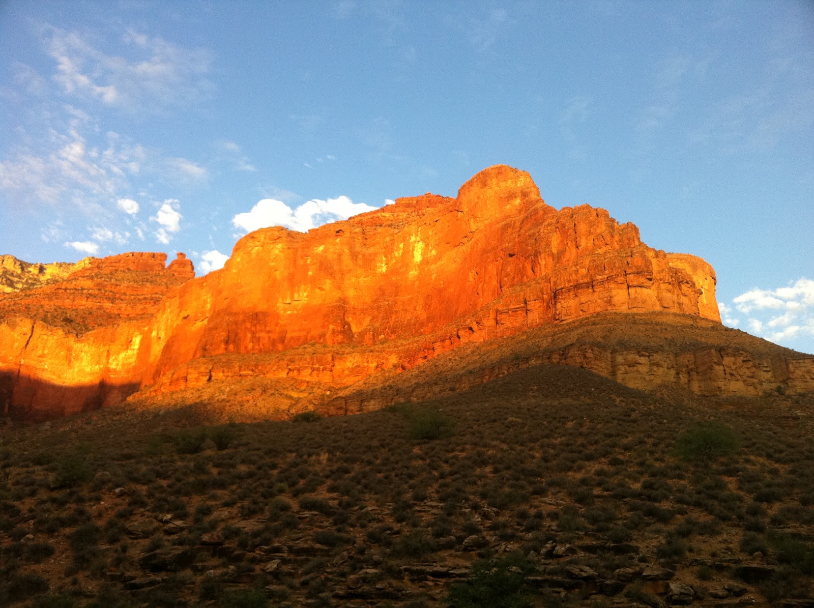
We spent the night before our Inca Trail run camping near the Llactapata archaeological site. After I climbed inside my tent and slipped inside my sleeping bag I turned on my flashlight to find my water bottle. Of course, I see a huge-ass spider staring right at me. I am petrified of spiders. I absolutely hate the little (or sometimes big) bastards. So I promptly started beating the hell out of the thing with the water bottle. Once assured of the spider’s demise, I turned off my flashlight for what would be one of the most restless nights in all of my time in Peru and Bolivia. 

I stared at the roof of the tent for what seemed like an eternity until I finally nodded off to sleep. When I woke up I expected it to be several hours later, boy was I wrong. To my surprise I had slept for only 15 minutes. Fifteen minutes! WTF?! Seriously? After a few more hours of gazing at the tent roof Geoff, my tent-mate, woke up to take a piss (somewhere around 1:30-2 AM). I remember making some comment about not sleeping at all and he said he had been lying awake all night long too. Damn, if I had known that at least I could have been talking to the guy. I think I may have got in another 5-10 minutes of sleep during the rest of the night. 

Needless to say, when the porters came to our tent at 3:45 AM for the wake-up call Geoff and I were already awake and making final preparations for our run. Geoff, as well as the other four runners in our group, were all packing Camelbaks full of several liters of water, energy gels, energy bars, sunblock, and just about anything and everything you can imagine. My preparations for the run were pretty easy; I filled two hand-held water bottles and put on a small waist band that was barely big enough to hold my camera. I slept in the clothes that I planned to wear running, which included a pair of running pants (I put these on over my running shorts so I could shed layers if it warmed up too much), a long-sleeved spandex shirt, a wind-proof and water-proof jacket, and a hat. This certainly made getting dressed a lot easier as all I had to do was put on my shoes.  

Eventually everyone made their way to breakfast, which was pretty damn good once again. We had porridge, banana pancakes, and coffee/tea. The coffee reminded me of one of my Golden Rules of running; always take a pre-game deuce. As I was following this rule one of the other runners in the group barged in on me for what was at the very least an awkward moment. I didn’t care, I have no shame. 

The original plan was to start the 15 minute hike from our campsite to the starting line at 4:45 AM so we could start at 5 AM. That didn’t happen. Finally, around 5 AM we left camp for the starting line. I had already hiked this trail the previous day when exploring the Llactapata area so I know what to expect more or less. The porters were making pretty good time heading up the trail and I was right on their heels. I figured the quicker I get up to the starting line the more time I would have to catch my breath before we actually started running…Seemed logical enough to me. 

Once the entire group reached the start line several runners began shedding layers in anticipation of the weather warming up a little. Not me. I’ve been too used to 100+ degree weather in Texas all summer. Plus I’m a huge pussy when it comes to being cold. So I kept all of my layers on, which proved to be a good decision because it was freezing on top of the first pass. Anyways, I would have an opportunity to shed layers at the first full aide station at mile 11 or so. 

We officially began the July 2011 Inca Trail to Machu Picchu 27.5 Mile Marathon at 5:15 AM. I was going to run almost 28 miles with 12,500 feet of vertical on less than 30 minutes of sleep…Fun stuff.
All of the runners charged fearlessly into the pitch-black darkness for an incredible day of running/hiking. I immediately took the lead and was never really challenged for the duration of the run, which turned out to be a bad thing since it screwed up the logistics of getting the runners through the various checkpoints. This meant I had to stand around and wait several times throughout the run. 

The initial 4-5 miles were on decent singletrack trail with rolling hills and an almost imperceptible increase in elevation. Every now and then I would have to slow down and move to the side of the trail for horses or donkeys to pass by since the initial miles of the trail were used by local peoples. 

At first, I took off at a pretty decent pace and my body felt great. After a mile or so our guide, Abelardo, informed me that there was a gate near Wayllabamba (about 4.5-5 miles from our start) that didn’t open until 6 AM (6 AM was our original scheduled time to start the run, but everyone in the group except me wanted to start at 5 AM because they didn’t think they could make it to the final checkpoint by the 3 PM cutoff time). Well, damn…This meant I would either have to slow down my running pace or keep my pace and wait 10-15 minutes for the gate to open when I arrived. I decided to slow down my pace a little, which sucked because I felt like giving the trail all I had at the moment. This was the first of several times I was forced to stop or slow down my pace. 

I arrived at the Wayllabamba gate shortly after 6 AM and began searching for the water-only aide station I thought should be there. After no luck finding the water station I decided I would need to start rationing my water (I started with 32 ounces and was now down to 12 ounces at this point) until the next aide station, which was about 7 miles away and on the other side of the 13,776 foot mountain pass I had to climb. Going 7 miles and another 4,000 vertical feet on 12 ounces of water was not going to be easy at all. I began to wonder what the hell I was doing out there. I certainly had plenty of time to think since I had to stop about every 100-200 feet to rest due to the altitude kicking my ass. This was really the only time during the entire run when doubt crept into my mind. 

Just as I was starting to abandon all hope I came across a porter on a section of the trail that seemed to be in the middle of nowhere. Beside the porter was a sign reading “Andes Adventures.” That’s me! To my relief he had lots of water with him. I filled up both my hand-held bottles, gave him my flashlight as a gift, and got back on my way. It was amazing how much “kick” got put back into my step after getting some water. 

Along the way up to the first pass I encountered several people. I used each person I passed as an opportunity to stop and rest for a while and also chat a little. The porters were always a great conversation even with our limited communication abilities. Although I thoroughly butchered the Spanish language, they always understood what I was trying to say. All of the porters were extremely supportive along the way and offered words of encouragement as well as applause. That might not seem like much, but it certainly did help.
Dead Woman's Pass is in sight, but it's much further away than it looks

Looking back on the valley where I started my ascent of the first pass. I'm between 1/2 to 3/4 of the way up at this point.

A mossy, wooded section of the trail

Awesome snow-capped peak in the distant view from the trail

Another great snow-capped peak

Eventually, I reached the top of the Warmiwanusq’a Pass, or Pass of the Dead Woman, at an elevation of 13,776 feet. It took me exactly three hours to reach the top of the pass from our starting point; a journey that covered about 10 miles and 5,000 vertical feet. Whew…Let me just say that it’s a tremendous feeling of accomplishment to look down all the way to the valley at the bottom and realize that you just ran/hiked your ass all of the way up to the top of the mountain pass. I paused at the top for about five minutes to take in the views, snap a few photos, and reflect on what I had just accomplished. I was still a long way from my goal of Machu Picchu (18 miles to be exact), but after making my way up Dead Woman’s Pass I had no doubt in my mind that I would finish easily. 
Finally at the top of Dead Woman's Pass. Looking back down to the bottom of the valley where I began my ascent.

Sun rising over the snow-capped peaks

After casual chit-chat with some Danes and Aussies atop the pass I decided it was time to move along. I began my descent to the next aide station (I believe it was near the Pacaymayu campsite, but I’m not 100% certain) about 2 miles down the mountain. Most of the descent was stone stairs, which were uneven and barely wide enough for half of my foot to fit. To make things even worse, near the top of the pass the stairs were covered in frost. Oh well, I decided to run down them anyways. To my surprise, I never fell. 
Top of Dead Woman's Pass. Looking over the other side that which I to descend.

Looking back up at Dead Woman's pass after descending part of the way. Look closely at the top of the mountain and you can see people. Those are the Danes and Aussies I talked with.

After about 25 minutes I reached the second aide station. Abelardo and a few porters were there waiting with water, Gatorade mix, hot soup, cheese sandwiches, bananas, oranges, and granola bars. I had worked up quite an appetite getting over the first pass. So the food sure did hit the spot. 

I spent about 30-45 minutes at the aide station, eating and talking with Abel and the porters. I used this opportunity to shed my jacket, but decided to keep the running pants, long-sleeved spandex shirt, and hat. I was somewhat encouraged to hang around the aide station longer than I would have liked. Apparently I was pretty far ahead of the other runners and it was messing with the checkpoint logistics. 

Well-fed and ready to go, I finally started up the second pass of the trail, Runkuraqay (elevation 12,470 feet). This pass wasn’t nearly as strenuous as the Dead Woman’s Pass; it covered 1,000 vertical feet in 1.25 miles. Abelardo informed me that it should take about 50 minutes to reach the top of the pass. I started out hiking up the pass because it was actually steeper than the first one. However, a goddamned bumble bee the size of a bird kept chasing me and wouldn’t leave me the hell alone. So I ended up running up several parts of the trail. When I got to the point where I felt my heart was going to explode I would quit running and pray that the bee quit following me. Moments later I would inevitably hear the buzzing of the bee, which made me take off running again. This happened several times until finally the bee decided to piss off. Luckily for me, this happened right about the time that the Runkuraqay ruins were in sight. I managed to catch up with one of the porters who went ahead of me from the aide station and had him snap a photo of me with the ruins. 
Ruins at the Runkuraqay Pass


Taking a break going up the Runkuraqay Pass

A nice little pond near the top of the pass

Looking back on the trail as I ascended the pass
 
At the top of the pass I stopped to talk with a group of three Colombians and their tour guide. They were doing a multi-day hike and seemed surprised at the fact that I was doing the entire trail in less than a day. I talked with them for 10 minutes or so which gave me plenty of time to recover from ascending the pass. I would have loved to sit and talk with them all day, but I had some running to do. 
At the top of Runkuraqay Pass looking down the side I would descend

Pausing for a photo on the descent from the Runkuraqay Pass

After the Runkuraqay pass it was literally almost all downhill to Machu Picchu. There were some small rolling hills and one more pass, but they were nothing compared to the two passes I had already climbed. This runnable section of trail made me realize that it’s fun to run past people who are slowly hiking along, using their trekking poles, and hear them say “what the hell?” as you pass by. Of course, I would stop and explain to them what I was doing mainly because I wanted to see their reactions. Some would ask if I was crazy. Some would ask if it’s even possible to run the trail in less than a day. However, all of them would say how awesome it was to do something like that. 
A few miles after the second pass (I think). Look closely at the mountain side and you can see a waterfall.

One of two or three tunnels on the trail.

Taken from the third pass looking back at the trail I had just run.
 
At about mile 17 I climbed the third pass (it was hardly a pass at all when compared to Dead Woman’s Pass and Runkuraqay) and arrived at the third and final aide station at the Phuyupatamarca campsite. As I entered the aide station area I was greeted with a truly pleasant surprise; about 10-20 porters started yelling and clapping for me! It was a great feeling to have all of these guys who bust their asses on the Inca Trail countless times a year cheering for me. 

Once again, the aide station had soup, sandwiches, fruit, etc. After eating and refilling my water bottles I was ready to hit the trail again. However, I was asked to wait around a little for the others to catch-up to me. Although I was ready to leave the aide station in 5 minutes or so I ended up spending 45 minutes there. This was the second time in the day I was forced to stop and wait for the others. Eventually Abelardo said it was cold at the pass and asked me if I was ready to start running again. Of course I was ready!

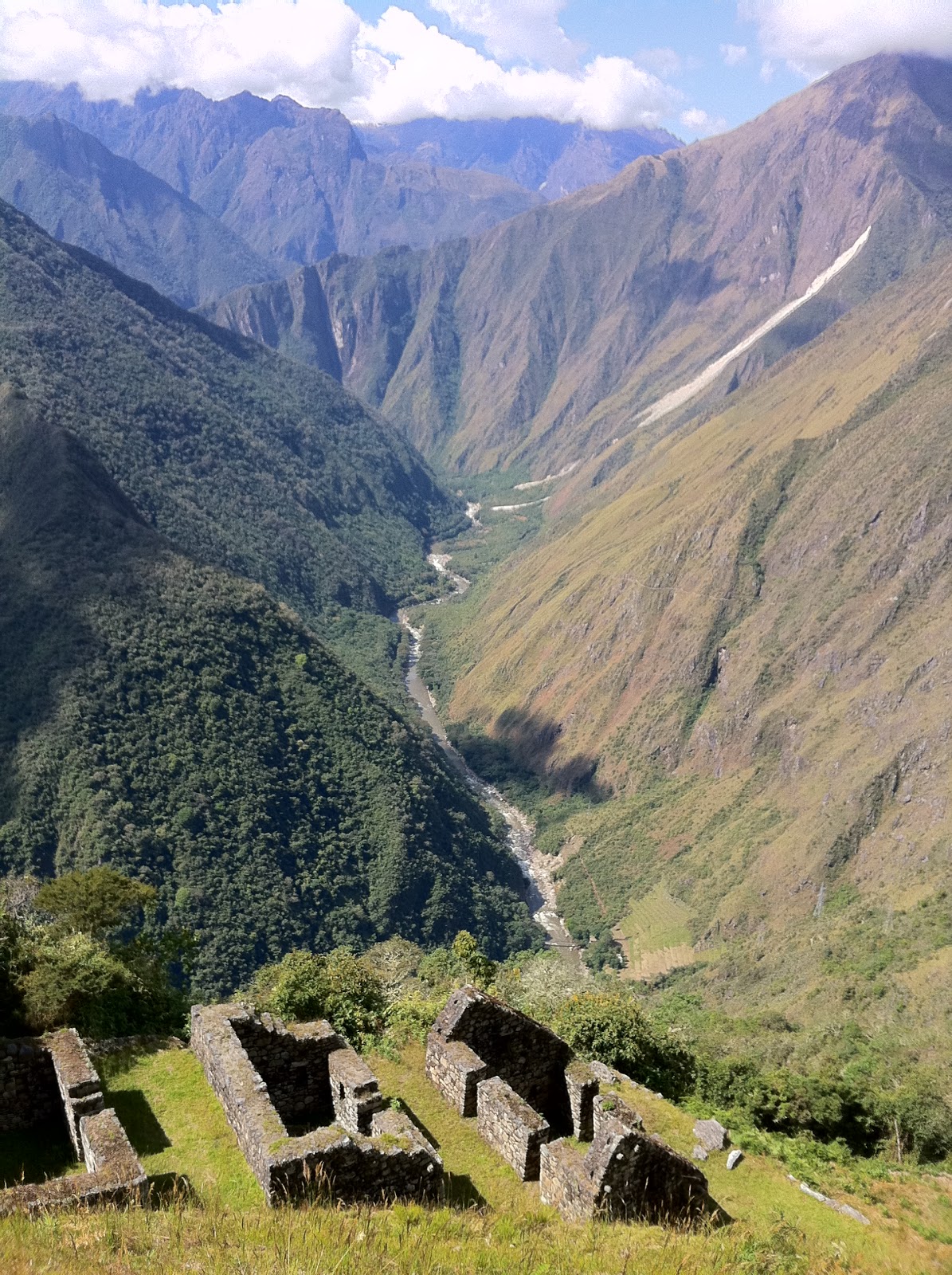
Abel led the way and I was right behind him the entire time. Even though this section of trail seemed to have an endless supply of stairs, it was one of the more runnable sections of the trail due to the constant descent. We ran without stopping until we reached the ruins of Winay Wayna, which offered some spectacular views. The agricultural terraces at Winay Wayna made a perfect rest stop for the two of us as Abel tried to make radio contact with the other tour guides. Apparently I was really far ahead of everyone else now. So there was no real urgency on my part to hit the trail and finish since I would just have to wait for the others to finish.
Photo of me on the terraces of Winay Wayna

Same photo as above only not as good since I'm not in it.

Photo from same spot as the previous two photos only includes some of the Winay Wayna ruins.
 
After Abel made some more logistical arrangements we hit the trail and started running again. Within a few miles we had reached the gate to enter the Machu Picchu site. This gate was the last checkpoint that everyone had to reach by 3 PM or else not be able to enter Machu Picchu that day. Abel decided to wait at the gate for the other runners while I opted to push on to the finish. 
The last checkpoint and entrance to the site of Machu Picchu. We had to arrive here by 3 PM or we would not be allowed into the park.
 
The next few miles proved to be the best running section on the trail since the first 3-4 miles. It was all singletrack, mainly dirt with some rocks, and best of all, little to no stairs! Yippie! I tore up this section of trail as fast as I could and most likely had an ear-to-ear smile on my face the entire time. Eventually I reached a steep staircase that led to Intipunku, Gateway of the Sun. On the way up the stairs I talked with a tour guide who asked where my group was. I explained to her that I was running the Inca Trail, which seemed to surprise her quite a bit. Anyways, I decided to stop for a few photos before reaching the Sun Gate and try to catch my breath (damn stairs) while she went on to the gate. 

When I finally reached the Sun Gate I was not only greeted with my first view of Machu Picchu, which was nothing short of life-changing. I was also greeted with about 20 or so people (maybe more) all clapping and cheering for me. Random strangers were coming up to get a picture with “the guy who just ran the whole trail in a day.” Apparently the tour guide I talked to on the way up to the Sun Gate told everyone up there what I was doing. It was a wonderful feeling. I stayed around the Sun Gate for 10-15 minutes taking photos, talking with random people, and just admiring the view. I had wanted to visit Machu Picchu for at least the last 10 years. Maybe longer…I can’t remember. Now, here it was, right in front of me. Words really can’t describe the feeling you get in a moment like that. So I won’t even try…
My first view of Machu Picchu after passing through Intipunku, The Sun Gate. Breathtaking...

Photo of me after passing through the Sun Gate
 
I soon realized that even though I was looking right at Machu Picchu I still had 1-2 miles to run and almost 2,000 vertical feet to descend to reach the finish line. Damn…I said goodbye to my new friends at the Sun Gate and took off running carelessly downhill. I couldn’t remember where the hell Abel said the official finish was so I just kept running until I saw someone that looked familiar. Eventually I saw Geoff’s (the New Zealander, remember?) family who told me I was about 100 meters from the finish. I crossed the finish line at around 1:45 PM. I believe the next finisher came across at 3:30 PM or so, but I can’t remember. 

The 27.5 mile Inca Trail, which includes about 12,500 feet of elevation gain and 4,500 stairs, is typically hiked over the course of 3-5 days. When it was all said and done I ran/hiked the Inca Trail in about 8 hours 30 minutes. Not too shabby…
Me at the finish line of the Inca Trail to Machu Picchu 27.5 Mile Marathon. Couldn't be happier :)

After the run my body felt great. I could very likely have kept running at least another 10 miles, maybe more. The other two finishers looked like they had seen better days. After a little rest and some photos we made our way to the bus station at Machu Picchu for the ride to Aguas Calientes. I wanted to run the approximately 5 mile trail down to the town, but to my disappointment Abel strongly suggested I just get on the damn bus. So I did. Oh well, I decided I would just run it the next day. 

Looking back on the race I feel that I’m capable of finishing much, much faster than 8.5 hours. I probably spent at least 1-1.5 hours waiting at the aide stations due to gap between me and the other runners. Another 0.5-1 hour can be attributed to stopping to take photos, of which I did plenty. I can’t even begin to imagine how much time I spent talking to anyone and everyone I passed on the trail, but odds are I could shave at least 1 hour off if I just shut the hell up and run. I’m fairly confident that I could run the trail in around 5.5 hours or so. Guess I will have to go back and try again…

Friday, August 19, 2011

Run Along the Urubamba River to Llactapata

Upon arrival at kilometer 82 Piscacucho, I promptly exited the bus, screamed “land!”, fell to the ground, and gave it a big kiss. I was happy to get off that goddamned death trap. I can run along cliffs and mountainsides all day long and not worry at all, but being in a charter bus and driving on one lane roads with drop-offs scares the shit out of me. 

Piscacucho was the start of our 6.5 mile run along the Urubamba River to kilometer 88, Qoriwayrachina, and on to the archaeological site of Llactapata where we would camp for the night.

Kilometer 82, Piscacucho

Nice snow-capped peak in the distance

Our run began on some smooth singletrack trail with some great mountain views and the Urubamba River alongside the trail. After a mile or so we made our way down to the railroad tracks that lead to the town of Aguas Calientes and tip-toed on the railroad ties for maybe a half mile before getting back on the singletrack. Overall, the run was quite easy with little elevation gain, very few hills, and smooth singletrack throughout. 
Urubamba River

Urubambaba River with trail
 
Eventually we came to a crossing of the Urubamba River. The crossing was on a wood plank bridge that looked like it dated back to the original Incan times. As I crossed the thought of falling through the bridge and into the white-water rapids below kept creeping into my head. So, naturally I decided to stop in the middle of the bridge and take a few photos. 
Sketchy old bridge to cross the river
Stopping in the middle of the bridge for a photo
 
After crossing the river there was about one more mile to go before reaching our campsite. The terrain was slightly more difficult than the previous few miles since it included several decent climbs. However, it was still very runnable. I ended up getting lost at a fork in the trail and had to back track a little. When I got back to the right trail one of our porters was there to meet me. He and I ran together to our campsite across from Llactapata. 
Me after the run. Llactapata in the background.
Llactapata without me in front of it

Home for the night :)

This was by far the most amazing place I had ever camped in my lifetime and I seriously doubt I will ever find anything that tops it. I spent the next 30 minutes or so speaking horrible Spanish with our porters while we waited on the rest of the group to arrive. Once the group arrived they all headed directly for the tents and took a nap. Not me. There were trails around the area begging to be explored. The fact that I just ran 6.5 miles and was going to run 27.5 miles the next day wasn’t going to stop me from exploring either. 

The trails around our campsite offered some pretty amazing views. I probably spent two hours or so wandering around the area (with the occasional burst of running), taking photos, and just taking in the sights, smells, and sounds. Being there just had a way of making me forget about all of the bullshit back in Texas, of making things seem good and right in the world. It’s a difficult feeling to explain, but for those who have felt it you will never forget that feeling.
Chasing ass up the trail

Another view of our campsite

Looking up at Llactapata

Another awesome view of Llactapata

It was about 4 PM now and back at the campsite the porters had prepared tea/coffee and snacks for us. The sun was settling in behind the mountains and the temperature was beginning to drop. So the nice, warm cup of coffee certainly did hit the spot. 

Not too long after coffee one of the porters brought a bucket of drinks from a nearby shop. I couldn’t help but notice there were three Cuzquenas in there. This certainly brought a smile to my face since my typical routine the night before a race or a long run includes having two or three beers. I asked around to see if anyone else wanted a beer. No one else wanted one! Jackpot! I popped the cap off my first beer and sat down to enjoy the scenery of Llactapata with the river roaring in the background. Life was good. 

As I popped the cap off my second Cuzquena two girls had just arrived on their way home from school. They had a soccer ball and seemed interested in kicking it around so I kindly obliged. I haven’t played soccer since Kindergarten so my skills are pretty much non-existent. Geoff, the family-man from New Zealand, joined in with us. We played until the sun went down and then continued to keep playing. At the time, there was nowhere else in the world I would rather have been. Even now I would go back in a heartbeat. It’s an amazing feeling anytime I can bring a smile or laughter to a child. 

It was now time for dinner and sadly that meant time to say “adios” to my soccer friends. Again I was surprised at how great the food was. The porters really were amazing cooks. After I had second and probably third helpings; our guide, Abelardo, brought out a bottle of Chilean wine to celebrate the journey we would begin bright and early the next morning. Abelardo said a traditional toast, we poured out a little wine on the ground for Mother Earth, and imbibed. 

Everyone turned in to bed relatively early as our 27.5 mile run on the Inca Trail to Machu Picchu was to begin at 5 AM the next day with a 3:45 AM wake up call.