High in Colorado

High in Colorado
Photo: Mandy Lea Photo

Friday, May 24, 2013

Falling a Little Behind...


Week in Review: April 29-May 5

Monday, April 29th
AM—14.5 Miles—3:34—4,800’—Flagstaff, Green, Bear, Green
I made plans to meet David Ponak at Chautauqua for a little fun in the mountains. We didn’t really know our route going into the run. So we decided to head up Green via Flagstaff then onto Bear and go from there. My legs and lungs felt like absolute crap all the way up Green; finding a breathing rhythm was nearly impossible. We cruised down Green Bear and grunted along the Bear Peak West Ridge until finally reaching the meat of the climb up Bear, which David graciously allowed me to lead. I have no idea how long it took us to summit, but it felt like a somewhat brisk pace. My perception is skewed though with my lack of acclimation. When we reached the junction of Bear Canyon I persuaded David to get in another summit of Green. It didn’t take long to realize that my legs had a little left in the tank and we proceeded to cruise up the Green Bear climb before power hiking the steep sections to the summit. The Greenman descent was pretty casual due to snow/slush, but once I hit Saddle Rock and Amphitheater I decided to test out the ole footwork on the steep descents. Footwork was perfect. Of course, about a tenth of a mile from Chautauqua, while running on the smoothest trail we had seen all day, I fell flat on my face. Figures…

Tuesday, April 30th  
AM—13.5 Miles—3:29—4,800’—Green, Bear, Green, Flagstaff
After my morning coffee at Trident I decided to head over to the Gregory lot for a run. I wasn’t really sure what, though. Naturally, I decided to head up the front side of Green and see what happened. The climb sucked. A lot. My legs felt like total crap after yesterday and it seemed to take everything in me to hike up the front side. At the summit, I gazed over towards Bear Peak and couldn’t resist heading over. After a casual descent I eventually reached the base of the climb and made my way up to the summit of Bear in about 11 minutes. With most of the snow melted I decided to push it down the steep, technical terrain on Bear until I reached the smooth trails of the West Ridge and just entered “coast” mode. The second climb up Green started really well with my legs seeming to be full of pep. Eventually that went away and left nothing but the lingering fatigue of about 30k feet of vertical over the last seven days. I hiked quite a bit of the climb up Green. At the summit I met two guys who asked about coming down via Flagstaff. So, rather than explain I decided to join and show them the way—a few extra miles, right? While descending I would coast on any smooth sections of trail and then burst to life on any technical sections—jumping over series of steps, swinging around trees near sharp turns, and basically just running without any regard for anything really. Since I’m still sucking on the ascents I seek out as much amusement on the descents as possible.
PM—4 Miles—1:11—2,200’—Green
With about four hours rest under my belt I decided to get in one more lap on Green before the impending snow storm rolled in and blanketed the trails. I power hiked pretty much anything that was vertical and ran the flats. Made it to the top 5 minutes faster than this morning. I’m ready for the upper portions of Greenman to melt off so I can put in a decent effort for the entire descent.

Wednesday, May 1st     
AM—5 Miles—2:48—2,400’—Green
It’s always hard to resist getting up Green when it’s covered in fresh powder. This trip was even more irresistible since it had been a year or so since my last trip up a white Green Mountain. I slogged up Green via the front side and descended via the middle route. I’m not sure I ever even ran a single step during the day, but it was enjoyable nonetheless. My hair, jacket, and pants were all covered in ice by the time I reached the Gregory parking lot.  

Thursday, May 2nd  
OFF—Recovery day after pushing things pretty hard during my first week back in Boulder

Friday, May 3rd  
AM—10 Miles—2:27—2,650’—Green
Super-slow ascent due to the snow and stomach problems. Ran into Fred on the summit and chatted for a bit. Then ran into Jim Rebenack on the summit and joined him for the descent via Bear Canyon. It didn’t take long into the descent for the stomach problems to show again. Jim dropped me somewhere on the Mesa Trail as I dealt with the stomach issues. Pretty “blah” day. Great to catch up with Jim a bit, though.

Saturday, May 4th  
AM—26 Miles—5:45—6,300’—Flagstaff, Green, Walker Ranch, Eldorado Canyon, Mesa
I met Von Bortz at Ebin G Fine where we proceeded up Green Mountain via Flagstaff and the middle route. With a little lingering shin/calf pain from the snow slogs I decided that I would simply hike anything snowy or muddy and uphill. We headed down the Green Mountain West Ridge to Flagstaff Road where we parted ways. I continued on with the typical backside loop through Walker Ranch, Eldorado Canyon, and back on the Mesa Trail. It was a pleasant surprise to have almost 100% mud-free trails on Walker Ranch and Eldorado Canyon; these were by far the best trails I ran all day. Mesa was a predictable shit-show of mud and water for the entire duration. Throughout the day I kept things at a super-easy effort and just enjoyed seeing all of the sights. This is always a fun loop.

Sunday, May 5th  
OFF—On the 7th day God created beer. And beer was good…


Miles—73
Time—19hours 16minutes
Elevation Gain—23,150 feet                                                                                                                           

Week in Review: May 6-12

Monday, May 6th
OFF

Tuesday, May 7th  
AM—5 Miles—5:03—2,800’—The Regency, Royal Arch Scramble and Green Mountain
I met up with Peter for a little scrambling to try out my new LaSportiva sticky’ish rubber shoes. We hiked to the base of The Regency where we began heading up. The first 20-30 feet proved to be fairly tense for me as I tried getting a feel for the shoes. I definitely almost took a 20-30’ish foot fall down the face of the rock. After that everything was smooth sailing. We eventually topped out and made our way to the top of the Royal Arch. I didn’t realize we were on top of the arch until some girls below asked how the hell we got up there. They of course gave us the always motivational words “don’t fall” right before we began the downclimb. Peter decided to shimmy up the Fifth, while I opted to hike up the access trail and meet him at the top. I’m easing into this scrambling thing. We then made our way to the summit of Green before a casual jog down the front side. Great day out.

Wednesday, May 8th    
OFF

Thursday, May 9th
OFF

Friday, May 10th
AM—3 Miles—1:09—1,150’—Second Flatiron Bailout
I decided to head out and try scrambling up the Second Flatiron for my first time. The trails were a little wet/muddy on the approach. When I got to the base I struggled to get the rubber on my shoes dry. After testing the grip for about 10 minutes or so I decided to start heading up. About 30 feet up I decided I wasn’t really comfortable with my grip. So, I downclimbed and just headed to Fort Collins to find a camping spot before Quad Rock.

Saturday, May 11th
AM—51 Miles—11:41—10,400’—Quad Rock 50 Miler (Fort Collins, CO)
I went into this race with absolutely zero expectations other than to finish. I was still struggling with the altitude after nearly 7 months at or around sea level. I took the first lap easy, walking every climb. However, my quads and hip flexors were still wrecked around mile 30. At mile 45’ish the grade mellowed out and I was able to run somewhat quickly to the finish clocking a few 6:30 miles. I had put in some long (10-15 hours) days 
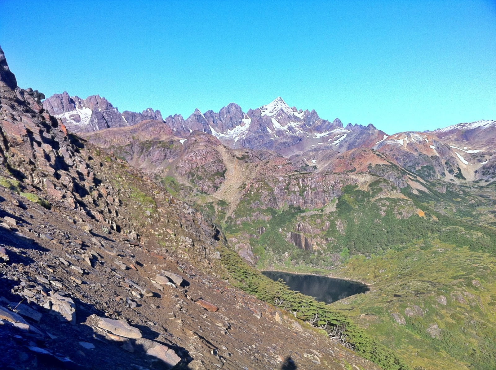
while in Patagonia, but the outings were all on rugged, technical terrain which essentially negated all running. So, it would take 14 hours to cover 25 miles. Quad Rock was the longest distance I’ve covered since running 43 miles at R2R2R in late October. It definitely showed…

Sunday, May 12th
OFF—Hip flexors and quads barely permitted walking


Miles—59
Time—17hours 55minutes
Elevation Gain—14,350 feet                                                                                                  


Week in Review: May 13-19

Monday, May 13th
AM—4 Miles—1:11—2,200’—Green Mountain
Barely able to walk when I woke up this morning. My quads and hip flexors are still a wreck after Quad Rock. Regardless, I headed to the Gregory lot with the intent of an easy hike up the frontside of Green. As soon as I put on my shorts and shoes it seemed that my legs came to life. I cruised up the front much quicker than anticipated (still slow as hell). I was even more surprised to find that my quads felt great on the descent and my footwork was near perfection. I decided to push the Amphitheater descent pretty fast since my footwork felt great.

Tuesday, May 14th
AM—9.5 Miles—1:55—3,050’—Green and Flagstaff
Met up with the old roommate Justin for a quick morning lap on Green before my acupuncture appointment. We Began at Ebin G Fine Park and ran up the backside via Flagstaff Mountain. My legs felt surprisingly great on the climb so I proceeded to run about 90% of the ascent up Green. The pace on the descent from Green’s summit to the four-way trail junction on Flagstaff was super casual. I decided to push the rest of the descent hard in an effort to finish in less than 1:55, but missed by just a few seconds. Still have a lot of speeding up to do.

Wednesday, May 15th
OFF—Travel day to NYC

Thursday, May 16th 
AM—7.7 Miles—1:02—200’—Central Park in NYC
Definitely not in the mountains any more. It felt incredibly weird to fun fast (hit sub 5-minute pace a few times) and flat with loads of people everywhere I looked. I turned this into a bit of a fartleck (spelling?) workout and ran hard for a minute or two, then easy for a few minutes, then repeat. This seemed to be a decent way to make break the monotony.

Friday, May 17th 
AM—17.2 Miles—3:10—1,100’—Palisades (New Jersey?)
I joined my friend Susie (who I randomly met in the bottom of the Grand Canyon last October) in an effort to seek out some trails in the big city. I met her at Central Park after a ~1.5 mile warm up and we took the subway north where we crossed a bridge (can’t remember the name) and hit some nice trails. About 14 miles of singletrack solitude was a welcome relief from the terrain and crowds of Central Park. Nice and easy pace the entire way.

Saturday, May 18th 
AM—13.1 Miles—2:10:17—200’—Brooklyn Half Marathon
Wow, 30-40k people running at once. Never seen anything like it. I had great company to run with the entire way, though. I ran with my friend Lauren and enjoyed the beautiful weather, while trying to take her mind off how shitty she felt. Can’t wait to get out and run with her again when she’s actually feeling well.  

Sunday, May 19th
OFF—Drank 4 or 5 liters of beer by accident. Whoops…


Miles—51.5
Time—9hours 30minutes
Elevation Gain—6,750 feet     


Sucking wind on top of Bear Peak (Photo: David Ponak)

Feels good to be on Bear Peak after such a long time away (Photo: David Ponak)
Cruising up The Regency and Royal Arch with Peter Bakwin

A summer of fun

Snow on Green Mountain!

Sunrise at the Flatirons is always a bit surreal

View of the George Washington bridge from the Palisades trail

Running the Palisades trail with my friend Susie

My favorite NYC subway ad

Packet pickup for the Brooklyn Half Marathon came complete with views of the Brooklyn Bridge (?) with Manhattan in the background and some nice fireworks

There's always money in the banana stand!

Running around Central Park

Celebrating my friend Lauren's birthday in Brooklyn. Definitely a more flattering photo of both of us than the ones from the Brooklyn Half Marathon :)
Soaking in the views of the Horsetooth Reservoir the night before Quad Rock

Horsetooth Reservoir again

Cruising downhill during Quad Rock. This was before my quads were rocked. (Photo: Michael Hodges)
                                                                                                               

Tuesday, April 30, 2013

Week in Review: April 22-28 -- Back to the Bubble


Monday, April 22nd
OFF—Calves were a little sore from the past few days of road running

Tuesday, April 23rd
OFF—Calves still a little sore

Wednesday, April 24th    
AM—None
PM—5 Miles—1:33—2,400’—Green Mountain
After the eleven hour drive from Kansas City to Boulder I had to shake out the legs on some familiar territory. After running the Baseline Trail to Amphitheater I fell into a power hike all the way to the summit. The view from the top was as beautiful as I remembered. Easy descent since this was my first time running in snow in a LONG time.

Thursday, April 25th
AM—10 Miles—2:29—3,250’—Flagstaff and Green Mountains
I parked at Ebin G Fine Park and began an easy run up Flagstaff. I was able to maintain a running pace the entire way up, but was startled at how long it took me to reach the top. Damn altitude. I proceeded on to Green via Ranger/Greenman and came down the same way. I never pushed on any of the ascent or descent. Easing into things…
PM—3.5 Miles—0:58—1,700’—Sanitas
My legs felt like crap, but I was tired of sitting in the coffee shop all day. So I decided to head out for a short one. Easy up, easy down.  

Friday, April 26th
AM—8.5 Miles—2:13—2,750’—Green Mountain
Great morning outing with Trent Briney. We headed up the 1st/2nd Flatiron access trail where he proceeded to kick my ass on the climb. Again, damn altitude. The upper portions of trail between the top of the Flatiron and the connection with Greenman were a bit snowy and gave me a chance to not get smoked by Trent too much. We descended down Bear Canyon and rode the Mesa Trail back to the Chautauqua lot. For the most part, the descent was a nice, cruiser pace that allowed us to enjoy the beautiful day, but we did push it in a few stretches. This was the first time I started giving a decent effort on some technical portions of descents, which happens to be one of my favorite parts of mountain running.
PM—5 Miles—1:40—2,400’—Green Mountain
I told myself I would take a break this evening. Trent and I finished running at 2 PM and I began this trip up Green at 5 PM. Not much rest. Death march up, easy down with some bursts on the descent down the front side.

Saturday, April 27th
AM—7.5 Miles—2:15—2,900’—Bear Peak
I decided to head up Bear Peak via Fern Canyon from the Cragmore TH with Tony Molina. In over a year of living in Boulder this was my first trip up Fern Canyon. Weird? My legs were not having any part of uphill running. So as soon as we hit Fern I fell into a hike all the way to the summit. At the saddle things got a bit interesting with some steep icy and packed sections of snow. Microspikes would have made this stretch nothing more than a typical steep section of trail, but without spikes it seemed like a death trap. We descended Bear Canyon. My legs were feeling great on the descent. I never really pushed as hard as I’m capable and I still put a 6-minute gap on Tony from the junction of Green Bear/Bear Canyon/Bear Peak West Ridge trails to the junction of Bear Canyon/Mesa (maybe 1.7 miles?). I love running fast downhill. The mental stimulation and the price you pay for any errors in footwork are certainly appealing.
PM—4 Miles—1:24—2,200’—Green Mountain
Super-slow on the way up. I took the first few switchbacks of the Greenman descent easy since I kept falling through the snow. After the switchbacks I opened up a little. I approached the Amphitheater descent with some reckless abandon and just had a blast as I completed that section of trail in around 3.5 minutes, give or take.

Sunday, April 28th
AM---4 Miles—0:50—1,150’—Flagstaff
I decided to get in a short, easy run before meeting up with Jack for some climbing in Boulder Canyon. I parked at the Gregory lot with no idea where I was going with only an hour to run. After heading up Gregory Canyon I decided to just head over for an easy summit of Flagstaff so that I could cruise down to my truck and be on time for climbing. I ran into Peter Bakwin and Jorge Delplata on the descent and may have made loose plans to join Peter on a Flatiron scramble in the near future. Any time you can join a badass like that for an outing you’d be a fool to decline. 
AM/PM—Sport Climbing in Boulder Canyon
I forgot how tough sport climbing can be. I’m sore as hell now. Sport climbing doesn’t seem as intuitive to me as trad. So, I end up flailing about on the wall for way too long until I’m completely spent. Fun day though. I almost forgot how breathtaking Boulder Canyon can be. 

Miles—47
Time—13hours 25minutes
Elevation Gain—18,750 feet 
                                                                                                             

Wow! It feels great to be back in Boulder, CO! I think I arrived at the most wonderful time of the year. Spring is in the air: birds are chirping, flowers blooming, streams flowing, and snow is melting!

After being at such low elevations for the past five months or so I can definitely feel the altitude with every uphill step I take. However, I’m surprised at how quickly I’m beginning to feel comfortable on the ascents. Hopefully I’ll be near normal for Quad Rock on May 11th. My times for this week are slow as hell, I realize that. My intent for this week was just to spend as much time in the mountains as possible and begin the acclimation process. I think I did a good job of this (I almost had 20k feet of vertical in five days). I think loads of vertical in as short of distances as possible will be a recurring theme for the summer.

I can already tell that not working for the summer and living in the Tacoma will have a positive impact on my running. It’s hard not to run twice a day when your only other option for amusement is to hang out in your truck or a coffee shop all goddamned day. 

Well, here’s to a wonderful summer of carefree running, scrambling, climbing, and whatever-the-hell-else in the beautiful mountains!


Thursday, April 18, 2013

Coming Home...


Well, today is the day (hopefully) that I return to the United States and eventually back to the serene beauty of my beloved Colorado.

Here's a little song that pretty much sums up how I'm feeling right now. Yes, I realize there are no words, but just watch the entire video and you should have some basic idea—the melancholy sounds of the keyboard, the dramatic ups-and-downs of the music, and the excitement of a child on Christmas morning coming from the guitar. They're all there; both in the song and in my mind. That’s as much as I really care to elaborate right now. Sometimes words just get in the way and complicate things even more than they already are.

In short,  I’m coming home…


Green Mountain--my first stop once I arrive in Boulder

Sunday, April 14, 2013

Running at the End of the World—Dientes de Navarino Circuit

The Location
Before packing my bags and heading south for the winter I solicited the Boulder Trail Runners for running suggestions. Peter Bakwin and Buzz Burrell both were quick to chime in. Among the many routes they offered was the Dientes de Navarino circuit accessed from Puerto Williams, Chile—southernmost city/town/village/whatever-you-want-to-call-it in the world! Getting to Puerto Williams is a bit easier now than it was when these two guys did the circuit. There are essentially daily boats from multiple carriers that depart Ushuaia for Puerto Navarino (a small port with two families living there) where you hop in a van for 50 kilometers or so to arrive in Puerto Williams.

While in Ushuaia I did a few good runs, but nothing overly spectacular. The city itself was bigger than I had hoped, noisy, full of loud/obnoxious street racing’ish cars, and just overall unpleasant. I refused to accept Ushuaia as El Fin del Mundo. In my eyes the end of the world should be much smaller and quieter—tranquilo. It should also be rugged and isolated with a surreal beauty that can be daunting at times.

Puerto Williams is where I found these things; the rugged isolation was everywhere. There is the potential to go out in the mountains for weeks there and never see another human being. These types of environments are what I love. Cliché as it sounds; it’s in places like this where you’re reminded just how insignificant you are in the grand scheme of things.

Intro to the Circuit
Typically, when I tell locals, park rangers, or trekkers about my running plans I get the same reaction—a look of disbelief that simultaneously says you’re an idiot, you’re full of crap, and you’re probably going to get yourself killed. I thought the looks/reactions I received in Bariloche, Chalten, and Ushuaia were bad, but they were nothing compared to those in Puerto Williams.

Apparently not too many people try to do this circuit in one day. And by not too many I mean that (from info in town from the locals, Carabineros, etc.)  I’m possibly the second or third party to try it one day, but I have a feeling there has to be others. Peter, Buzz, Lisa, and Stephanie did the loop in 11:26 back in 2005—starting and finishing at Plaza de la Virgen. Someone told me a group of English fell runners have done it in 8-9 hours, but I can’t find any record of that anywhere (not saying it didn’t happen just can’t find any proof). I may possibly be the first person to do it solo in one day, but again I’m sure someone else has likely already done this—just can’t find any record. I can’t possibly fool myself into thinking that I’m the only trail runner in the world dumb enough to go down here and do this route solo in one day…

So, I decided to approach this circuit with a goal of besting 11:26. Starting at Plaza de la Virgen there is about 1.2 miles of gravel road running to reach the trail head. The trail finishes about 4.5-5 miles west of the Plaza. Everything else is technical mountain trails with a total absence of cruiser singletrack. In total, the circuit is around 54’ish kilometers when you start and finish at the Plaza. 
Starting Point--Plaza de la Virgen
Disappointment in the Dientes—First Try on the Circuit
After scouting out the weather for a few days I decided on the 14th of March as THE day. After my morning coffee, a small breakfast, and my last minute preparations Cecilia (owner of Refugio El Padrino) was gracious enough to escort me to the Carabineros (police) to let them know that the dumb gringo was planning to do a 5-day trek in one day and give me a ride to the Plaza de la Virgen for the start.

Around 8:30 AM, mas o menos, I took off. From the start my legs felt lethargic as I struggled to find a rhythm running up the 1.2’ish mile gravel road in the frigid morning air. I eventually reached the peak of Cerro Bandera and was rewarded with a great view off the Beagle Channel and Puerto Williams down below. The trail then cruised along the mountain side for a few kilometers deeper into the valley. The descent down to Laguna del Salta was a bit of a death trap—sharp talus covered with frost from the brisk morning. After almost falling several times I finally opted to put on my Microspikes for the descent and risk dulling them prematurely. The fun wasn’t over after the descent. I still had to boulder hop from the northeast shore to the southwest shore of the laguna with the dreaded ice still mocking me every step of the way. 
Pretty cold start to the day
View from Cerro Bandera
The climb from Laguna del Salto to Paso Primero was a fun slog through a small, muddy stream of cascading snow melt with mud sometimes coming to about 6-inches above my ankles. I got duped into one or two side trips between Paso Primero and Paso Australia since they were marked with cairns just like the main trail. After Paso Australia I got to play in a few snow fields before popping over Paso de los Dientes for another stretch of icy talus and boulder hopping. Again, the stretch from Paso de los Dientes until first glimpse of Laguna de los Dientes was scenic yet uneventful—seemingly never-ending boulder hopping for the most part. 
Between Paso Primero and Paso Australia
Boulder hopping
Laguna de los Dientes is where things got a bit interesting. I didn’t know it at the time, but the trail markers split in both directions around the laguna. I chose to head south—I chose poorly. After slogging my way through beaver-devastated shorelines I found myself at the southern edge of the laguna. I was debating heading back to where I first caught glimpse of the laguna (and the last trail marker I had seen) when I noticed a couple of cairns. There were no other cairns to be found after though. I searched around for over an hour trying to find the trail. 
Beaver damage everywhere.
Finally, 2 PM arrived—the self-imposed “commit or quit” time I had chosen. I decided to turn around and retrace my steps back to the beginning of the route and admit defeat. I didn’t bring any gear for enduring a cold night in the rugged mountains and I certainly wouldn’t be able to follow the route in the dark. Turning around at 2 PM gave me plenty of time to get safely out of the mountains before darkness.
View from Cerro Bandera as I retreated back to the warmth of El Padrino
I was a bit sickened at my problems with route finding. Mainly because the day I chose to do the route turned out to be perfect in every way—no wind, no precipitation, and shirtless-running temperatures. Damnit…

Stats for the day:
Miles—24
Vertical—7,600 feet
Time—10 hours 45 minutes

Who Actually Learns the Lesson the First Time?—Second Try on the Circuit
I sat in Refugio El Padrino for the next few days as I watched the weather turn to absolute crap—rain, wind, clouds, and cold. This sickened me even more. I came to the end of the earth—a place notorious for predictably unpredictable weather—and blew my one shot at completing the circuit in near-perfect weather conditions. I kept watching the weather forecast though…Just in case.

About four days after my failed attempt another glorious day came out of nowhere. Armed with better route information (I thought at the time) I prepared for another go. This time I set out to do everything on my own—let the Carabineros know I’m an idiot and make my way on foot to the start at Plaza de la Virgen (a 20 minute warm-up). It didn’t take long to warm-up because the morning was surprisingly hot compared to the morning of my first attempt.

My legs felt fresh and ready to go from the beginning. I was making great time up to Cerro Bandera and looked to top out in about 45 minutes or so—10 minutes faster than previous. About 10 minutes from the summit some stomach issues needed to be addressed. This gave me the opportunity to shed some layers and get everything resituated so it wasn’t that much of a disappointment. Nature calls sometimes, right?
Heading into the valley towards the Dientes
Having already covered this section of the trail made it pretty easy this time around. I arrived at the south shore of Laguna del Salto in 2:18—12 minutes faster than before. I seemed to dispose of the trail pretty effortlessly until I arrived at the shore of Laguna de los Dientes at the 3:41 mark—almost 2 hours faster than previous. With the kilometers quickly passing I began thinking that the 11:26 goal was totally do-able. And then I lost the trail…for the first time…
All smiles after 2-3 hours on my feet

Moving from Paso Primero to Paso Australia

View after Paso Australia
First glimpse of Laguna de los Dientes
It seems that the map I have was made in 2003. Ten years is a LONG time for a plague of beavers to dramatically alter the landscape. This means the map that I bought is now nowhere near accurate in terms of depicting bodies of water for the area, which makes it incredibly easy to lose the friggin’ trail. Fortunately, the topography is one thing the beavers can’t change.

I confused one of these beaver flood zones as Laguna Escondida and with a very brief glance at my map confirmed this. So, without a cairn in sight I decided to push up-and-over some random mountain pass, which turned out to be somewhat difficult. Things didn’t really get interesting until I topped out on the pass and caught glimpse of this big, beautiful lake—Laguna Esondida. Damnit…

I was now faced with the decision of going back down and around Cerro Gabriel to get to Laguna Escondida the safe way (on the actual trail) or descending about a 40-60% grade (depending on route finding) of loose scree/talus/boulders to get down. I really didn’t feel like backtracking so I let the shit-show commence.

Shortly after committing to the sketchy descent I realized it was a mistake and I’d likely get injured, but I had already committed and going up didn’t really seem like a good option now. With each step I watched layers of scree and talus go sliding down the mountain side. A boulder or two would occasionally gain some momentum and crash down the slope all the way to the bottom to make sure I was aware of how stupid this idea really was.  

When I finally reached the shore of Laguna Escondida and rejoined the trail I had been out for over 5.5 hours (5:32 to be exact). It took me almost 2 hours to cover 1.5 kilometers of the official trail by detouring up-and-over the sketchy pass, which I now call Paso del Idiota (Pass of the Idiot). I still held on to a faint hope of besting the 11:26 mark, but I didn’t have much more tolerance for route-finding errors. 
Looking at the descent that awaited me from Paso del Idiota
The trail from Laguna Escondida, over Paso Ventarron, and down towards Laguna Hermosa was technical, but well-marked and runnable. Around Laguna Hermosa is where I encountered my next route-finding error. Again, the cairns just seemed to disappear. Without the trail in sight I took matters into my own hands yet again and proceeded up-and-over an even sketchier pass than Paso del Idiota—I called this pass Paso ‘thehellwasIthinking.

On the way to Paso Ventarron
The descent down this pass was pretty much equivalent to the descent down Paso del Idiota, but the big difference was the ascent. The ascent was about 60% grade of alarmingly loose scree, talus, and boulders that proved nearly impossible to climb. I opted to bust out the Microspikes again and utilize the snow/ice that I had been trying to avoid. One slip on the snow/ice would lead to me sliding about 100 meters or more down to the bottom where some nice, soft rocks awaited to break my fall (or break something). So I climbed with my left side on the snow and my right side in the rocks to hopefully allow for easy exit from the snow if I should lose traction.

From Paso ‘thehellwasIthinking I caught a glipse of the unmistakable Laguna Martillo with the Montes Lindenmayer mountain range—a pretty spectacular sight. I made my way towards the southeast shoreline where I finally rejoined with the trail and could enjoy the comfort that only cairns can provide. Upon reaching the shoreline I realized that my right shoe was completely blown out. The upper was separated from the sole from heal-to-toe, which would essentially eliminate all running I could do for the remainder of the circuit. 
Shores of Laguna Martillo
I began the muddy, boggy slog from the shores of Laguna Martillo to the beginning of the final challenging ascent to Paso Virginia. Of course, I got off trail again. After some mindless wandering without a cairn in sight I had decided to just follow the valley in a northwesterly direction back to the main coastal road. This idea didn’t last for too long since I quickly realized the deathtrap I would be facing—ridiculous amount of downed trees mostly hidden under thick layers of undergrowth that would break under the slightest amount of weight. So I decided to head upward above treeline in search of Paso Virginia in hopes that I could somehow get back to signs of civilization before dark. The path of least resistance proved to be a small mountain stream with countless downed trees crisscrossing it. I eventually got above treeline to notice a roaring mountain stream, cascading gradually down the slope—just like the Lonely Planet guidebook said. Upon further inspection, I found a cairn! 

I stumbled from cairn-to-cairn like a drunken idiot with hobo shoes until I topped out at Paso Virginia and eventually got my first glimpse of the other side. Laguna los Guanacos, a beautiful valley, and the Beagle Channel all seemed so close. I finally had my first sighting of the route back to civilization! Perhaps the most comforting feeling was looking down and being able to see a well-defined trail for a significant distance, which convinced me that I would make it back before dark. Oh, how deceiving looks can be…
View from Paso Virginia of Laguna de los Guanacos and the Beagle Channel
The descent from Paso Virginia to the shores of Laguna los Guanacos included a steep-as-hell section of scree surfing, which would normally be much welcomed fun. However, in shitty shoes sans socks this proved to be extremely painful with every poke and prod from the larger, sharper rocks. Once I got to the northern shore of Laguna los Guanacos I ran into David and Paula (two guides who were staying at the same hostel as me) at around 7:30 PM. I chatted with them for a bit, politely refused their offerings of food, and nodded with them in agreement that I should be able to easily cover the remaining 2.1 km back to the road before dark. I had about an hour to cover the last 2.1 km before darkness set in—easy, right? Not at all. 
Looking back at the descent from Paso Virginia that included two sections of talus surfing.
Almost immediately after parting ways with David and Paula I began a section of bushwhacking with mud coming up to 4-5 inches above my ankles in places—the entire time hoping the soles of my shoes would just stay attached for a little while longer. I eventually reached the moderate relief of an obvious trail, but had to endure sharp rocks piercing my feet once more. And then the true shit-show started; meandering through thorn bushes, prickly plants, and a mixture other things that hurt like hell as I wandered aimlessly in the dark among a maze of cattle trails. Fortunately, I knew where I needed to go—down.

Eventually, I bottomed out somewhat in a small river bed and then had no idea what direction I needed to go. I put my watch in compass mode and just started moving north crisscrossing the river, hopping up and over downed trees, and barging through thorn bushes. After doing this for a while I emerged from the forest to a flat, grassy area with some big, unknown object looming in the distance. As I got closer I soon realized it was a ~10 feet high cattle fence. Much to my relief, as I neared the fence I soon realized that just in front was the main coastal road! I had just completed the Dientes de Navarino solo and self-supported in 14’ish hours! Now I just had to run about 8 kilometers on a gravel road with destroyed shoes to get back to town. Shit…

After a few minutes of searching for the motivation to run I set off in a trot, slowly increasing my cadence until I hit a decent running pace, with the intent of not stopping again until I reached town. I could already tell that it was going to be a miserable experience with my feet sliding off the soles of my shoes with each step.

A couple minutes into running I noticed a light shining in the distance. I covered my headlamp to make sure I wasn’t hallucinating or something. Then I heard voices. As I neared I realized it was Max and Jorrit, two friends staying at my hostel, who got a bit worried about me when it was dark and I hadn’t returned yet. So they borrowed the hostel owner’s car to come see if they could find me.  When I reached them it was a no-brainer for me—I was taking a ride back. My intent was to close the loop back to Plaza de la Virgen, but given the circumstances—busted shoes and not on FKT pace—I decided that simply doing the trail section was more than enough. I took a beer from the guys, hopped in the car, and rode back into town completely exhausted after 14.5 hours or so on my feet in the rugged, isolated mountains. 
What my shoes looked like for half of the 14+ hour outing
I consumed only 600 calories in VFuel gels and a few liters of water during the entire day and never really felt dehydrated or lacking in energy. I’m continually amazed at how much activity I can do with little-to-no VFuels during the course of the run.

Stats for the day:
Miles—25
Vertical—10,000 feet
Time—14 hours 17 minutes

Best part of the entire day (besides being in the mountains for 14 hours) was returning back to the hostel where the owner, Cecilia, had prepared an amazing seafood soup for dinner. The soup seemed to warm every part of my body that had started to freeze during the last few hours of wandering around in the dark.

Big thanks to:
·         VFuel for the energy to play in the mountains all day long
·         Cecelia and Refugio El Padrino in Puerto Williams, Chile for making me feel at home
·         Max and Jorrit for greeting me at the finish with a beer and giving me a ride back home
·         Peter Bakwin for route information and sharing the wealth of knowledge he has