
After almost a week in Indian Creek perfecting my crack
flailing abilities I decided to head down to the Grand Canyon for a
Rim-to-Rim-to-Rim effort. I headed south on a Saturday with no real knowledge
of the area surrounding the Canyon. So, I decided to settle down in Flagstaff
for the night until I could get on the internet and find places to car camp
near the GC.
Just outside of Flagstaff a turnoff for national forest
access presented itself, which naturally begged to be explored. Eventually I found
a road that dead-ended at a trailhead for the Inner Basin Loop. After six hours
of driving the Taco stand a run sounded both wonderfully appealing and
hauntingly appalling. So I ran…
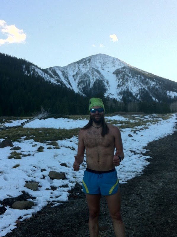
The temperature was nice and cool, but felt warm enough to
justify running sans shirt (at least until 15 minutes into the run when the sun
fell below the mountains). Regardless, I still maintained the casual pace I
intended. I was rewarded with a few stunning views of the turning Aspens as
well as decent views of some of the San Francisco peaks once I reached the
Inner Basin. A nice-and-easy 5 mile run with 1,100 feet of vertical in 54
minutes. Not too shabby for just hopping out of the Taco after driving for six
hours…
 |
| Aspens!!! |
 |
| My dumb ass in the cold all in a desperate attempt to annoy Rob Timko. Just wish my head wrap had an upside-down visor on it... |
 |
| Chilly running conditions |
 |
| A nice sunset on the way down from the trailhead |
After dinner and beer at some unmemorable brewery in
downtown Flagstaff (what can I say? Colorado breweries have spoiled me…) I parked
El Taco Blanco in the Motel 6 parking lot and had one of the most uncomfortable
nights of sleep I’ve had in a LONG time.
Some early morning research (and napping) at a local coffee
shop had me ready to go tackle Mount Humphrey’s—the highest point in Arizona at
12,633 feet or something like that. When I rolled into the parking lot of the
Arizona Snow Bowl and began changing into running clothes the stares began. Most
noticeable was a couple standing by some table near the TH. I assumed they were
going to ask me to register to vote or something so I avoided eye contact like
the plague. Turns out they were doctors conducting research on the effects of
altitude on hikers up Mount Humphreys.
 |
| Driving along Kendrick Street to get to the Humphrey's trailhead |
The docs seemed a bit surprised when I told them of my plans
to run up the mountain and be at the top in the one to one-and-a-half hour
range depending on how bad the snow was. I was the 16th person to
sign up for the study with person #1 having about a three hour head start. My goal
was to be every last one of them to the top.
I took off at a comfortable yet decent pace up the super
runnable grade—stopping to talk to anyone who felt like talking along the way. About
a mile or so into the 5 mile ascent the trail started getting snowy/slushy/icy.
Near the saddle the snow was deep and soft enough that I either kept falling
through the snow pack or couldn’t get traction. So I fell into an easy power
hike for most of the remainder of the ascent with the exception of the last ¼ to
½ mile, which I ran pretty hard. I topped out around 1:30 and was immediately
hooked up to the doctor’s machine to be tested. Not really sure what all the machine told him
(O2 saturation, heart rate, other things?), but my heart rate dropped from 150
to 70 within one minute of topping out. The doc seemed impressed. Maybe it was
my heart rate or maybe it was the fact that I beat everyone except the #1
person in the test to the top. Number 1 beat me by less than five minutes. That
bastard…
 |
| First glimpse of the Mount Humphrey's summit (far right) and several false summits along the way |
 |
| Mount Humphrey's summit post |
 |
| Looking back at the path I took up to the summit |
The descent was pretty much an uncontrolled glissade through
slush—hoping and praying that I didn’t fall and crack my head open on one of
the many exposed rocks. Really fun stuff. For some reason I got a lot of weird
looks while doing this…
After a few more miles of slipping and sliding I eventually
hit some rooty (but runnable) terrain, which I coasted on back to the trailhead
for my last round of doctor testing. I finished the 10 miles with 3,300 feet of
vertical run in 2:53. Really mellow, but not bad considering how much snow was
out there and that I was running in it with essentially no traction at all—the 110’s
I was wearing had 500+ miles on them and not much tread left. I would love to
go back and run Humphrey’s without snow since it’s such a mellow grade.
With my legs sufficiently warmed up I decided to Taco camp
off a forest service road in Tusayan to get into the Grand Canyon park gates
early and avoid paying the entry fee.
You shave your legs. That's all I have to say. you SHAVE YOUR LEGS! What are you, a Triathlete?
ReplyDeleteYou just now realized this? I swear I caught you checking out my legs long before I posted this photo...
ReplyDeleteI'm glad I don't have to survive using the hair on my chest.
ReplyDeleteLooks like some good fun.
Chest hair certainly makes for a good base layer.
ReplyDelete